THE HISTORICAL
MARKER DATABASE
“Bite-Size Bits of Local, National, and Global History”


3 entries match your criteria.  


Related Historical Markers

 
By G.W.Bartlett, June 26, 2026
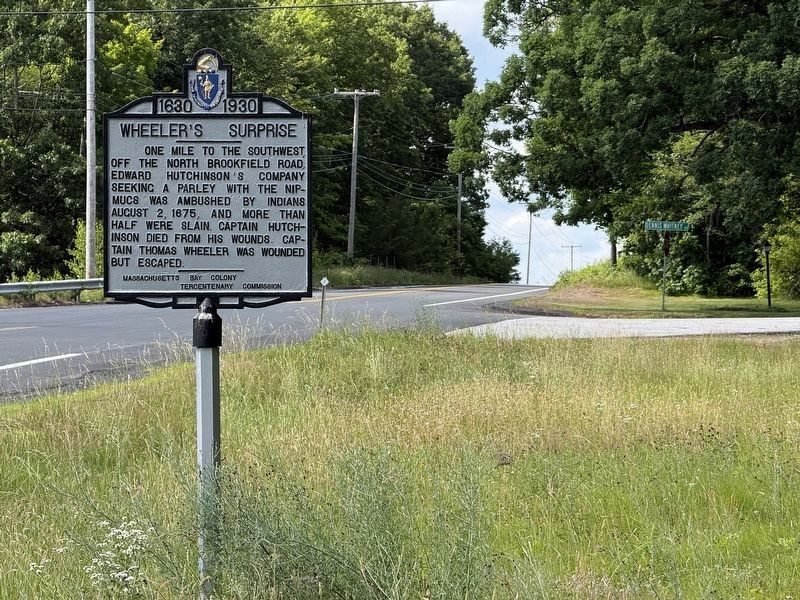
Wheeler’s Surprise Marker
SHOWN IN SOURCE-SPECIFIED ORDER
1 ► Massachusetts, Worcester County, New Braintree — Wheeler’s Surprise — 1630 – 1930 —
On Barre Road (Massachusetts Route 67) at Daniel Whitney Road, on the right when traveling north on Barre Road.
One mile to the southwest, off the North Brookfield Road, Edward Hutchinson’s company seeking a parley with the Nipmucs was ambushed by Indians August 2, 1675, and more than half were slain. Captain Hutchinson died from his wounds. Captain Thomas . . . — — Map (db m311802) HM
2 ► Massachusetts, Worcester County, West Brookfield, Quaboag Plantation — The Fortified House —
On Foster Hill Road just west of George Allen Road, on the left when traveling west.
Here stood the fortified house besieged in King Philip’s War Aug. 2-4 1675 — — Map (db m311571) HM WM
3 ► Massachusetts, Worcester County, West Brookfield, Quaboag Plantation — John Ayres — Killed by Indians 2d - 1675 - Aug. —
On Foster Hill Road 0.1 miles west of George Allen Road, on the right when traveling west.
By graunt of the Great & General Court, 1660 a founder of "Quaboag Plantation" an isolated frontier outpost, now Brookfield 1960. First Sergt. Ayres, Prichard and Coy were massacred "on an affayre to meet with the Indians who declare . . . — — Map (db m311542) HM WM


CeraNet Cloud Computing sponsors the Historical Marker Database.
This website earns income from purchases you make after using our links to Amazon.com. We appreciate your support.
Paid Advertisement
Nov. 13, 2026
