2 entries match your criteria.
Related Historical Markers
To better understand the relationship, study each marker in the order shown.
By Alan Edelson, June 17, 2010
The Province Line Marker
SHOWN IN SOURCE-SPECIFIED ORDER
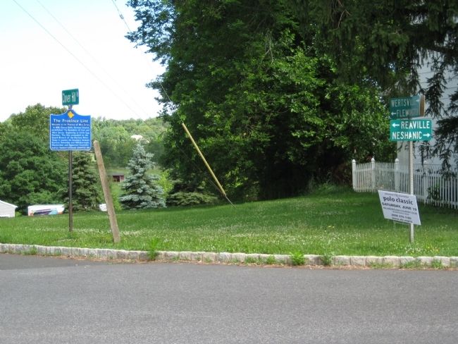
| On Clover Hill Road at Amwell Road, on the right when traveling north on Clover Hill Road. |
| | In 1688, George Keith, Surveyor General, established The Boundary of East and West Jersey. Beginning at Little Egg Harbor, The line extended to the South Branch of the Raritan River. Today it remains the boundary between Raritan Township and . . . — — Map (db m31957) HM |
| On Province Line Road at Hopewell - Rocky Hill Road (County Route 518), on the right when traveling south on Province Line Road. |
| | In 1664, the Duke of York sold New Jersey, or "Nova Caesaria" to Lord Berkley and Sir George Carteret.
East Jersey: Carteret's Trustees sold a "Half" in 1682 to twelve associates, thereafter proprietors of East Jersey.
West Jersey: Berkley . . . — — Map (db m16862) HM |
Jun. 1, 2024