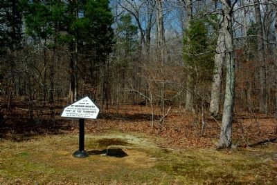
Near Eastern Corinth Road 0.2 miles south of Peabody Road, on the left when traveling south.
U. S.
Camp of
18th Missouri Infantry,
Miller's (2d) Brig., Prentiss' (6th) Div.,
Army of the Tennessee.
First position in line of battle April 6, 1862, was 300 yards in front of this camp. — — Map (db m43244) HM
Near Eastern Corinth Road 0.2 miles south of Peabody Road, on the left when traveling south.
U. S.
18th Missouri Infantry,
Miller's (2d) Brig., Prentiss' (6th) Div.,
Army of the Tennessee.
This regiment was engaged here from 7.30 a.m. to 8.30 a.m. April 6, 1862. It then fell back to its camp. — — Map (db m42772) HM
Near Eastern Corinth Road 0.2 miles south of Peabody Road, on the left when traveling south.
U. S.
18th Missouri Infantry,
Miller's (2d) Brig., Prentiss' (6th) Div.,
Army of the Tennessee.
This regiment was engaged here from 8.30 a.m. to 9 a.m. April 6, 1862. A small portion of the regiment was with General Prentiss at his 3d . . . — — Map (db m42799) HM
On Sunken Road 0.2 miles east of Eastern Corinth Road, on the left.
U.S. 18th Missouri Infantry,
Miller's (2d) Brig., Prentiss' (6th) Div.,
Army of the Tennessee.
About 100 men of this regiment were engaged here,
under General Prentiss, from 9 a.m. to 5 p.m. April
6, 1862 and surrendered with him at . . . — — Map (db m38280) HM