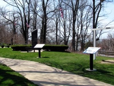
These are the markers of the St. Joseph Maritime Heritage Trail. To study the markers in their order along the trail, read each marker in the order shown.
By Duane Hall, April 26, 2013
St. Joseph Maritime Heritage and Lighthouses on the Pier Markers
On Lake Boulevard north of Market Street, on the left when traveling north.
Two historic waterways, Lake Michigan and the St. Joseph River, meet here. Opportunities for maritime trade, transportation, industry and recreation led to the founding of St. Joseph and Benton Harbor. Explore the Maritime Heritage Trail and . . . — — Map (db m68151) HM
On Lake Boulevard north of Market Street, on the left when traveling north.
The north pier lighthouses, built in 1907, guide ships to this port. The inner light replaced a smaller, wooden lighthouse in use since 1847. The north pier was then extended and the outer light tower was added, allowing mariners to find the harbor . . . — — Map (db m68152) HM
On Lake Boulevard north of Elm Street, on the left when traveling north.
The Great Lakes region is one of the nation's most important centers of maritime commerce. Lighthouses helped mariners navigate these vast inland seas. In 1832, the U.S. Government built the first lights on Lake Michigan at two of its busiest . . . — — Map (db m68176) HM
On Lake Boulevard north of Elm Street, on the left when traveling north.
From its opening in 1891, the Silver Beach Amusement Park made St. Joseph a prime destination for tourists. Huge crowds enjoyed the park's many attractions, which included a carousel, roller rink, indoor swimming pool, bowling alley, beer garden, . . . — — Map (db m68177) HM
On Lake Boulevard at Pleasant Street, on the left when traveling north on Lake Boulevard.
The waters off St. Joseph and Benton Harbor have long served as an active and frequently dangerous avenue of maritime trade. High winds and hazardous waves made shipwrecks a common occurrence.
To assist mariners, a U.S. Life Saving Service . . . — — Map (db m68194) HM
On Lake Boulevard at Port Street, on the left when traveling north on Lake Boulevard.
The meeting of river and lake provided a natural setting for a harbor at St. Joseph. Human engineering would ultimately develop the port into one of the busiest on Lake Michigan.
In the 1830s, at the urging of local merchants, the U.S. Corps of . . . — — Map (db m68195) HM
On Water Street east of State Street, on the left when traveling east.
St. Joseph and Benton Harbor once ranked among the nation's leading boatbuilding centers. From 1892 to 1955, waterfront facilities of the Truscott Boat Manufacturing Company, Dachel-Carter Shipbuilding Corporation, and Robinson Marine Construction . . . — — Map (db m68202) HM
On Water Street east of State Street, on the left when traveling east.
Two historic waterways, Lake Michigan and the St. Joseph River, meet here. Opportunities for maritime trade, transportation, industry and recreation led to the founding of St. Joseph and Benton Harbor. Explore the Maritime Heritage Trail and . . . — — Map (db m68203) HM
On Water Street east of State Street, on the left when traveling east.
With a ready supply of lumber and a thriving port, St. Joseph and Benton Harbor offered a natural setting for shipbuilding. As early as the 1830s, sailing and steam-powered vessels were built here for lake and river navigation.
Shipbuilders . . . — — Map (db m68204) HM
Near Water Street east of State Street, on the left when traveling east.
Whether paddling a canoe, riding a riverboat, or sailing a yacht, pleasure boating has always been a favorite St. Joseph activity. Recreational boating has remained popular due to well-stocked fishing grounds and accessible private and city marinas. . . . — — Map (db m68216) HM
Near Water Street east of State Street, on the left when traveling east.
Schooners rigged for sailing and steam-driven freighters were once common sights at St. Joseph and Benton Harbor. Fruit, lumber, and manufactured goods made up much of the port's early trade. By the 1870s, vessels were regularly carrying thousands . . . — — Map (db m68217) HM
On Water Street west of State Street, on the right when traveling west.
A U.S. lighthouse supply depot was built at St. Joseph in 1893. For a quarter century, this depot equipped all of Lake Michigan's lights with materials ranging from lenses to lamp oil. Operations of the St. Joseph Depot were transferred to Milwaukee . . . — — Map (db m68218) HM
On Water Street west of State Street, on the right when traveling west.
St. Joseph's swing bridge allows passage for both maritime and railroad commerce. An alternative to a drawbridge, the swing bridge pivots open for vessels to pass and closes for trains to cross. St. Joseph's swing bridge is typically left open until . . . — — Map (db m68223) HM
On Water Street west of State Street, on the right when traveling west.
Commercial fishing was one of St. Joseph's earliest maritime trades. Native Americans and the settlers who followed found the river and lake full of trout, whitefish, sturgeon, and perch. By the 1900s, family-run fisheries became major contributors . . . — — Map (db m68224) HM