THE HISTORICAL
MARKER DATABASE
“Bite-Size Bits of Local, National, and Global History”


2 entries match your criteria.  


Related Historical Markers

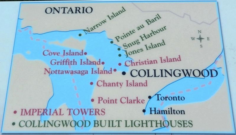
Collingwood Lighthouses
 
Marker detail: Collingwood Lighthouses
SHOWN IN SOURCE-SPECIFIED ORDER
1 ► Ontario, Simcoe County, Collingwood — Water Transportation via Collingwood 1854-1900 —
On Huron Street (Provincial Highway 26) at Heritage Drive, on the right when traveling east on Huron Street.
1854 — Sophia, passenger & cargo ship carrying flour, lumber, fish & potash between Kingston, Whitby, Toronto, Port Credit, Port Stanley, Sarnia, Owen Sound, HENS & CHICKENS, & Penetang. HENS & CHICKENS was later renamed COLLINGWOOD. . . . — — Map (db m304299) HM
2 ► Ontario, Simcoe County, Collingwood — A Harbour in Need of a Lighthouse / Un phare pour le port de Collingwood —
Near Heritage Drive 1.2 kilometers north of Huron Street (Provincial Highway 26).
[English] A Harbour in Need of a Lighthouse Collingwood’s harbour was hazardous for navigation in the 1800s. When Collingwood became the northern terminus of the Ontario, Simcoe and Huron Railway in 1855, marine . . . — — Map (db m304296) HM


CeraNet Cloud Computing sponsors the Historical Marker Database.
This website earns income from purchases you make after using our links to Amazon.com. We appreciate your support.
Paid Advertisement
Oct. 19, 2026
