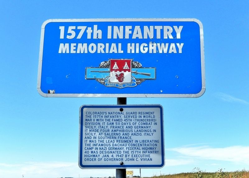
On U.S. 40 0.3 miles east of County Road 60, on the right when traveling west.
Colorado’s National Guard regiment the 157th Infantry, served in World War II with the famed 45th (Thunderbird) Division. It saw 511 days of combat in Sicily, Italy, France and Germany. It made four amphibious landings, in Sicily, at Salerno and . . . — — Map (db m287893) HM
On County Highway 36 at County Highway 63.2, on the left when traveling south on County Highway 36.
The southeast corner of the Nebraska panhandle was organized November 6, 1888 from a part of Cheyenne County. Deuel County has two incorporated towns, Chappell, the County Seat and Big Springs.
Before 1850 Teton Sioux Indians camped on the . . . — — Map (db m119438) HM
On Commerce Road south of Old U.S. 24, on the right when traveling south.
Welcome to Land and Sky Scenic Byway, a land of expansive sky and agricultural abundance.
The expanse of land and sky extending in all directions provides an excellent
opportunity to see the agricultural abundance of Kansas in addition . . . — — Map (db m282332) HM
On Commerce Road (Kansas Route 27) south of Old Highway 24 (Business U.S. 24), on the right when traveling south.
The Land and Sky Scenic Byway
In the High Plains of Western Kansas, the first Native Americans in the area were nomadic, relying on the area's large herds of bison. As the Spanish brought their horses to the Americas, horse culture . . . — — Map (db m281876) HM
Thin black lines indicate changes in relevance. Between each pair of lines entries are ordered geographically but all have the same relevance.
* Inflectional forms of words are their plurals, singulars, and possessives as well as gramatical tenses and similar variations.