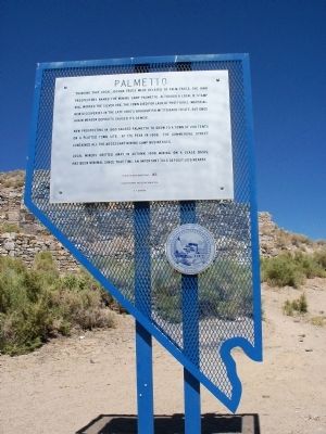
On Nevada Route 266, 31 miles west of U.S. 95, on the right when traveling west.
Thinking that local Joshua trees were related to palm trees, the 1866 prospectors named the mining camp Palmetto. Although a local 12-stamp mill worked the silver ore, the town died for lack of profitable material. New discoveries in the late 1860's . . . — — Map (db m35150) HM
On Lone Mountain Road (Nevada Route 854) 0.8 miles south of 7 Troughs Road ( Route 399), on the right when traveling north.
Although rarely recognized or celebrated, the members of Northern Nevada's Chinese immigrant population have contributed significantly to the state's history and culture through the building of the Northern Nevada railway system, and their vital . . . — — Map (db m218954) HM
Near Central Avenue at Western Avenue, on the right when traveling south.
Here was a key point on Nevada's earliest road, the famed Humboldt Trail that brought 165,000 imigrants west in the 1840's and 50's. Travelers named this rich valley the Big Meadows and stopped for water and grass before continuing south to cross . . . — — Map (db m67898) HM
On Marzen Lane, on the right when traveling south.
Mazuma, Nevada was once a small mining town in Pershing County. The name "Mazuma” is
derived from a Yiddish slang word for money. One of four towns settled during the 1907 gold rush in the Seven Troughs Mining District, Mazuma was centrally located . . . — — Map (db m194790) HM
On Marzen Lane, on the right when traveling south.
Col. Joseph Marzen was born in Germany in 1928 and immigrated to New York City in 1846.
He quickly learned he was born to be a butcher and honed his craft there until he went west to Sacramento, CA in 1851. Not one to settle down yet, he moved on . . . — — Map (db m194789) HM
Thin black lines indicate changes in relevance. Between each pair of lines entries are ordered geographically but all have the same relevance.
* Inflectional forms of words are their plurals, singulars, and possessives as well as gramatical tenses and similar variations.