THE HISTORICAL
MARKER DATABASE
“Bite-Size Bits of Local, National, and Global History”


2 entries match your criteria.  


Related Historical Markers

 
By Robert Woods, February 24, 2014
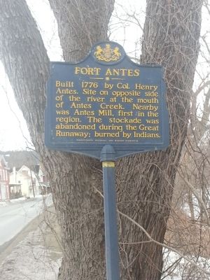
Fort Antes Marker
SHOWN IN SOURCE-SPECIFIED ORDER
1 ► Pennsylvania, Lycoming County, Jersey Shore — Fort Antes —
On North Main St. (Pennsylvania Route 44), on the right when traveling north.
Built 1776 by Col. Henry Antes. Site on opposite side of the river at the mouth of Antes Creek. Nearby was Antes Mill, first in the region. The stockade was abandoned during the Great Runaway; burned by Indians. — — Map (db m71975) HM
2 ► Pennsylvania, Clinton County, Avis — Tiadaghton Elm —
Near River Road at Local Route 436.
Under this huge Elm, July 4, 1776, resolves declaring independence were drawn, prior to news of action by Congress at Philadelphia. This was an expression of the spirit common to the frontier and led by the famous Fair Play men. — — Map (db m65556) HM


CeraNet Cloud Computing sponsors the Historical Marker Database.
This website earns income from purchases you make after using our links to Amazon.com. We appreciate your support.
Paid Advertisement
Nov. 11, 2026
