2 entries match your criteria.
Related Historical Markers
By Cosmos Mariner, May 30, 2014
Camp Verde, Texas Marker (detail view)
SHOWN IN SOURCE-SPECIFIED ORDER
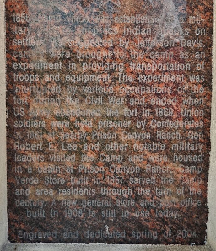
| 1 ► Texas, Kerr County, Center Point — Camp Verde, Texas — |
| On San Antonio Street south of Kelly Street, on the right when traveling north. | |||
| 2 ► Texas, Kerr County, Kerrville — 20166 — One Mile to Ruins of Camp Verde — |
| Near Bandera Highway (State Highway 173) at East Verde Creek Road, on the left when traveling south. | |||