5 entries match your criteria.
Related Historical Markers
By Brandon Fletcher, June 1, 2013
Illustration Map
SHOWN IN SOURCE-SPECIFIED ORDER
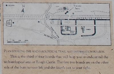
1 ► United Kingdom, Scotland, Falkirk — The Northern Defences — of the Fort at Rough Castle — #3 —  |
| Near Bonnyside Road. | |||
| 2 ► United Kingdom, Scotland, Falkirk — The Antonine Wall — At Rough Castle — #2 — |
| Near no nearby street. | |||
| 3 ► United Kingdom, Scotland, Falkirk, Bonnybridge — Antonine Wall Rough Castle — |
| Near Bonnyside Road at Bonnyside Road. | |||
| 4 ► United Kingdom, Scotland, Falkirk — Antonine Wall — Rough Castle — |
| Near no nearby street. | |||
| 5 ► United Kingdom, Scotland, Falkirk — The Roman Fort — An Annex at Rough Castle — #4 — |
| Near no nearby street. | |||