5 entries match your criteria.
Related Historical Markers
The Gordon Stockade
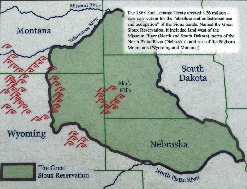
Marker detail: The Great Sioux Reservation
SHOWN IN SOURCE-SPECIFIED ORDER
| Near U.S. 16A east of Lower French Creek Road, on the right when traveling east. |
| Near U.S. 16A east of Lower French Creek Road, on the right when traveling east. |
| Near U.S. 16A east of Lower French Creek Road, on the right when traveling east. |
| Near U.S. 16A east of Lower French Creek Road, on the right when traveling east. |
| On Lower French Creek Road, 0.2 miles south of Stockade Lake Drive (U.S. 16A), on the left when traveling south. |
Jun. 3, 2024