4 entries match your criteria.
Related Historical Markers
By Mike Wintermantel, February 12, 2014
Craney Island Marker
SHOWN IN SOURCE-SPECIFIED ORDER
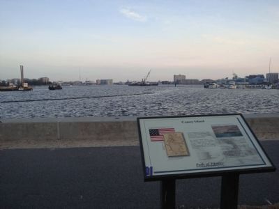
| | Craney Island played a significant role in the War of 1812, flying the Flag of 1795, with fifteen stars and stripes. American defenders held off overwhelming British forces there on June 22, 1813. Two hundred British soldiers were . . . — — Map (db m21111) HM |
| | Seven miles northeast in the Elizabeth River is Craney Island, a landmark of two wars. During the War of 1812, the British attacked its fortifications on 22 June 1813, but were repulsed by its defenders including the Portsmouth artillery. During the . . . — — Map (db m38265) HM |
| | On the morning of June 22, 1813, during the War of 1812, British naval and marine forces under the command of Admiral Sir John Borlase Warren landed here at Hoffler Creek. American armed militia under the command of Gen. Robert B. Taylor blocked the . . . — — Map (db m22154) HM |
| | Buried beneath this canal stone lies Lock #3 of the Alexandria Canal, which connected the Harbor of Alexandria with the Chesapeake and Ohio Canal in Georgetown, D.C. between 1843 and 1886. After Crossing the Potomac on an aqueduct bridge near the . . . — — Map (db m80668) HM |
Apr. 26, 2024