Craney Farms / Green Acres in Portsmouth, Virginia — The American South (Mid-Atlantic)
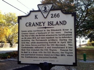
Craney Island
Erected 1997 by Department of Historic Resources. (Marker Number K-266.)
Topics and series. This historical marker is listed in these topic lists: Forts and Castles • Roads & Vehicles • War of 1812 • War, US Civil. In addition, it is included in the Virginia Department of Historic Resources (DHR) series list. A significant historical month for this entry is April 1861.
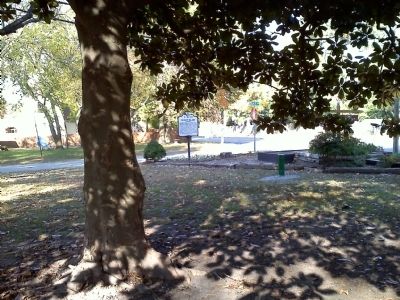
Location. 36° 50.652′ N, 76° 21.986′ W. Marker is in Portsmouth, Virginia. It is in Craney Farms / Green Acres. Marker is at the intersection of High Street West (U.S. 17) and Duke Drive, on the right when traveling east on High Street West. Touch for map. Marker is at or near this postal address: 3145 Duke Drive, Portsmouth VA 23703, United States of America. Touch for directions.
Other nearby markers. At least 8 other markers are within 3 miles of this marker, measured as the crow flies. General Lafayette Memorial (approx. ¾ mile away); A Living Memorial (approx. ¾ mile away); V. C. Andrews Monument (approx. 1.1 miles away); Lest We Forget (approx. 1.1 miles away); Benedict Arnold at Portsmouth (approx. 1.9 miles away); City of Portsmouth (approx. 2.2 miles away); Israel Charles Norcom High School (approx. 2.6 miles away); Mount Calvary Cemetery Complex (approx. 2.8 miles away). Touch for a list and map of all markers in Portsmouth.
Credits. This page was last revised on October 26, 2023. It was originally submitted on November 19, 2010, by James Thomson of Chesapeake, United States. This page has been viewed 1,280 times since then and 46 times this year. Last updated on November 21, 2010, by James Thomson of Chesapeake, United States. Photos: 1, 2, 3. submitted on November 19, 2010, by James Thomson of Chesapeake, United States. • Craig Swain was the editor who published this page.


