3 entries match your criteria.
Related Historical Markers
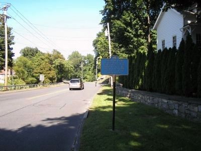
Four plaques in all were erected along the route between Stewart International Airport and West Point.
By Bill Coughlin, September 20, 2008
Marker in West Point
SHOWN IN SOURCE-SPECIFIED ORDER
| | The route traveled by the 52 American hostages from Stewart Airport to West Point after their release from captivity in Iran January 25, 1981. — — Map (db m11713) HM |
| | The route traveled by the 52 American hostages from Stewart Airport to West Point after their release from captivity in Iran January 25, 1981. — — Map (db m8215) HM |
| | The route traveled by the
52 American hostages from
Stewart Airport to West
Point after their release
from captivity in Iran
January 25, 1981. — — Map (db m44035) HM |
May. 23, 2024