Near Rich Square in Northampton County, North Carolina — The American South (South Atlantic)
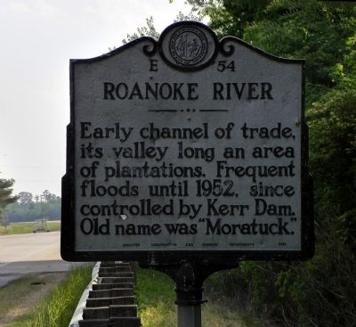
Roanoke River
Erected 1954 by North Carolina Archives Conservation and Highway Department. (Marker Number E-54.)
Topics and series. This historical marker is listed in these topic lists: Industry & Commerce • Natural Features • Natural Resources. In addition, it is included in the North Carolina Division of Archives and History series list. A significant historical year for this entry is 1952.
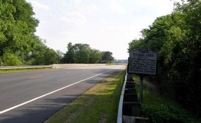
Location. 36° 12.595′ N, 77° 22.959′ W. Marker is near Rich Square, North Carolina, in Northampton County. Marker is on U.S. 258, 4.8 miles south of Chapel Hill Church Road (North Carolina Highway 1108), on the right when traveling north. Touch for map. Marker is in this post office area: Rich Square NC 27869, United States of America. Touch for directions.
Other nearby markers. At least 8 other markers are within 6 miles of this marker, measured as the crow flies. A different marker also named Roanoke River (about 700 feet away, measured in a direct line); Ram Albemarle (approx. 0.2 miles away); Trinity Church (approx. 4.7 miles away); Veterans Memorial (approx. 4.7 miles away); Whitmel Hill (approx. 4.7 miles away); W. W. Kitchin (approx. 4.8 miles away); Claude Kitchin (approx. 5.3 miles away); Prof. George Madison James (approx. 5.8 miles away).
Related marker. Click here for another marker that is related to this marker. To better understand the relationship, study the marker shown.
Also see . . . The Nature Conservancy in North Carolina - Roanoke River Landscape. (Submitted on May 26, 2010, by PaulwC3 of Northern, Virginia.)
Credits. This page was last revised on March 30, 2021. It was originally submitted on May 26, 2010, by PaulwC3 of Northern, Virginia. This page has been viewed 816 times since then and 22 times this year. Photos: 1, 2, 3. submitted on May 26, 2010, by PaulwC3 of Northern, Virginia.
Editor’s want-list for this marker. Photos of Kerr Dam (Boydton, Va.) • Can you help?


