
2 entries match your criteria.
Related Historical Markers
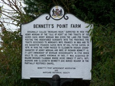
By Beverly Pfingsten, October 19, 2007
Bennett's Point Farm Marker
SHOWN IN SOURCE-SPECIFIED ORDER
1 ► Maryland, Queen Anne's County, Queenstown — Bennett’s Point Farm —  |
| Originally called “Morgan’s Neck.” Surveyed in 1658 for Henry Morgan of the “Isle of Kent” as two tracts of 150 acres each. Henry Morgan was given the land for transporting two indentured servants into the province. The tracts descended to Morgan’s . . . — — Map (db m3128) HM | |||
| 2 ► Maryland, Queen Anne's County, Queenstown — “Morgan’s Neck” / Richard Bennett III • his wife Elizabeth Rousby — / 1667–1749 • 1682–1740 — |
| “Morgan’s Neck” “Morgan’s Neck” (300 acres) was patented by Cecil Calvert on January 26, 1658, to “Henry Morgan, of the Isle of Kent, gentleman,” for transporting into the province Frances Malyn and Francis Ash. The tract descended to his . . . — — Map (db m3125) HM | |||