5 entries match your criteria.
Related Historical Markers
To better understand the relationship of the Blue Mountain Forts, study each marker in the order shown.
By Craig Swain, July 1, 2007
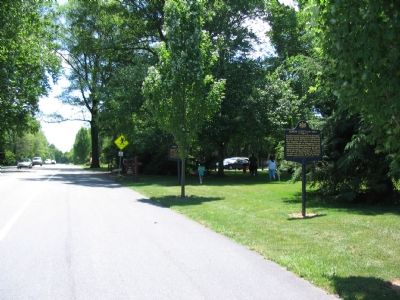
Two Markers at Fort Hunter Park Entrance
SHOWN IN SOURCE-SPECIFIED ORDER
| | Stockaded blockhouse, built 1755-56, on the site of present Fort Hunter Museum. Used to protect the frontier and as a supply base in building Fort Augusta. Abandoned and fell to ruins after 1763. — — Map (db m1511) HM |
| | In this vicinity stood James Brown's log house-fort, named Fort Manda when garrisoned as an outpost of Fort Swatara from January, 1756 to May, 1757. Its usual complement consisted of 21 officers and men. No description of the fort has survived. — — Map (db m12508) HM |
| | Nearby stood Patton's Fort, a station of the Paxton Rangers, who defended the gaps and farmsteads along the Blue Mountains from the Susquehanna River to Swatara Creek, near Indiantown, against Indian raids from 1756 to 1763. — — Map (db m31295) HM |
| | North at the head of Beaver Creek, Joseph Barnett's loghouse was a frontier refuge in 1756-63 against Indians raiding the frontier. His son William was stolen by Indians in 1756 and not recovered until 1763 by Col. Henry Bouquet. — — Map (db m31296) HM |
| | Originally built by Peter Hedrick, 1755. The stockaded blockhouse was improved in early 1756 by Capt. Frederick Smith to guard Swatara Gap and protect the frontier settlements. Site is on Fort Swatara Drive about half a mile from this intersection. — — Map (db m12538) HM |
Apr. 24, 2024