5 entries match your criteria.
Related Historical Markers
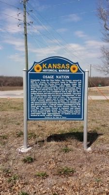
By Ryan Purcell, March 22, 2015
Mission Neosho Marker
SHOWN IN SOURCE-SPECIFIED ORDER
| | The first Indian mission and school in present Kansas was established in September, 1824, about five miles west of this marker. Benton Pixley, the missionary, followed Chief White Hair and his band of Great Osages who had migrated from Missouri . . . — — Map (db m46198) HM |
| | [Front]
Historic Harmony Mission, a school for the Indians of Missouri, once stood east of Rich Hill, on the north bank of the Osage River, near the centuries-old camping sites of the Great and Little Osage tribes.
The mission was founded . . . — — Map (db m121349) HM |
| | During the Civil War, militias from both the Union and Confederate sides were stealing the Osages' cattle, harassing their villages, and blaming the Indians for raids actually committed by Americans. Osage leader Charles Mongrain cautioned everyone . . . — — Map (db m60477) HM |
| |
The small area (about 12 by 10 miles) where Osage Village State Historic Site is located, contains almost all of the Osage sites and early French and American sites relating to the Osage in Missouri.
1. Osage Village Site
The site on . . . — — Map (db m61407) HM |
| | In memory and dedication to those whose foresight, frustrations and sacrifices have helped the Osage Tribe to preserve its identity [sp], development and culture.
1865 - The Osages agreed to the sale of their Kansas lands.
1871 — . . . — — Map (db m55653) HM |
May. 13, 2024