Near Independence in Montgomery County, Kansas — The American Midwest (Upper Plains)
Drum Creek and the Civil War
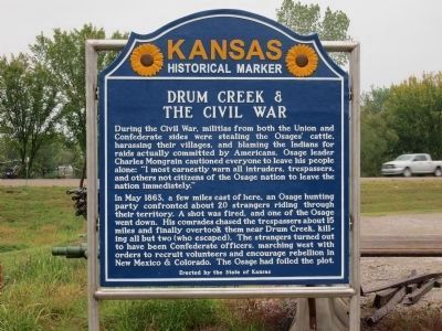
Inscription.
During the Civil War, militias from both the Union and Confederate sides were stealing the Osages' cattle, harassing their villages, and blaming the Indians for raids actually committed by Americans. Osage leader Charles Mongrain cautioned everyone to leave his people alone: "I most earnestly warn all intruders, trespassers, and others not citizens of the Osage nation to leave the nation immediately."
In May 1863, a few miles east of here, an Osage hunting party confronted about 20 strangers riding through their territory. A shot was fired, and one of the Osage went down. His comrades chased the trespassers about 15 miles and finally overtook them near Drum Creek, killing all but two (who escaped). The strangers turned out to have been Confederate officers, marching west with orders to recruit volunteers and encourage rebellion in New Mexico & Colorado. The Osage has foiled the plot.
Text of Previous Edition of the Marker
In May, 1863, a mounted party of about twenty Confederates, nearly all commissioned officers, set out from Missouri to recruit troops in the West. Several miles east of here they were challenged by loyal Osage Indians. In a running fight two Confederates were killed and the others were surrounded on a gravel bar in the Verdigris river about three miles north of this marker. Ignoring a flag of surrender, the Osages scalped and cut the heads off all but two of the party. These, wounded, hid under the river bank and escaped.
After the war when settlers began staking claims on the Osage reservation, Congress authorized removal of the tribe to present Oklahoma. In 1870 a treaty was signed in a grove on Drum creek, three miles southeast. Ironically, the cheap lands to which the Osages were removed became a great oil field and for a time they were the wealthiest people per capita in the world.
Erected 2012 by State of Kansas. (Marker Number 56.)
Topics and series. This historical marker is listed in these topic lists: Industry & Commerce • Native Americans • Settlements & Settlers • War, US Civil. In addition, it is included in the Kansas Historical Society series list. A significant historical month for this entry is May 1863.
Location. 37° 13.495′ N, 95° 40.35′ W. Marker is near Independence, Kansas, in Montgomery County. Marker is at the intersection of Main Street (U.S. 160) and 4410th Street, on the left when traveling east on Main Street. There are official signs on US 160 pointing out the location of the marker, which is slightly off the main road. Touch for map. Marker is in this post office area: Independence KS 67301, United States of America. Touch for directions.
Other nearby markers. At least 8 other markers are within 2 miles of this
marker, measured as the crow flies. Dewlen - Spohnhauer Memorial Bridge (approx. 0.3 miles away); Etchen Studebaker Sales & Service (approx. 1.8 miles away); Stoddard - Thompson Memorial Bell (approx. 1.8 miles away); F-100F Super Sabre (approx. 1.8 miles away); United Spanish War Veterans Memorial (approx. 1.9 miles away); Replica of the Statue of Liberty (approx. 1.9 miles away); Princess Cartwright's "Remington" (approx. 1.9 miles away); Kayo's Boys (approx. 2 miles away). Touch for a list and map of all markers in Independence.
Also see . . .
1. Osage Nation. Tribe website homepage (Submitted on January 24, 2022, by Larry Gertner of New York, New York.)
2. Leaving the Banks of Drum Creek. Kansas GenWeb website entry (Submitted on February 24, 2012, by William Fischer, Jr. of Scranton, Pennsylvania.)
Credits. This page was last revised on January 24, 2022. It was originally submitted on February 24, 2012, by William Fischer, Jr. of Scranton, Pennsylvania. This page has been viewed 1,771 times since then and 81 times this year. Last updated on October 22, 2012, by Jamie Cox of Melbourne, Florida. Photos: 1. submitted on October 22, 2012, by Jamie Cox of Melbourne, Florida. 2, 3. submitted on February 24, 2012, by William Fischer, Jr. of Scranton, Pennsylvania. • Bill Pfingsten was the editor who published this page.

![Civil War Battle [and] Drum Creek Treaty Marker. Click for full size. Civil War Battle [and] Drum Creek Treaty Marker image. Click for full size.](Photos1/194/Photo194233.jpg?69201382700PM)
![Civil War Battle [and] Drum Creek Treaty Marker. Click for full size. Civil War Battle [and] Drum Creek Treaty Marker image. Click for full size.](Photos1/194/Photo194234.jpg?2242012110900PM)