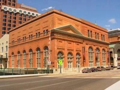
On East Wells Street 0.1 miles west of North Water Street, on the left when traveling east.
In this station pulverized coal was first successfully burned continuously and at high efficiencies in furnaces of stationary steam boilers November 11-15, 1919. This radical departure from conventional firing methods of the period was vigorously . . . — — Map (db m80527) HM
On Washington Ave., on the right when traveling north.
Interurban Bridge
In 1907, the Milwaukee Northern Railway Company constructed this riveted-steel Thru Truss Bridge over Cedar Creek. Manufactured by Carnegie Steel and measuring 159 ft. long by 12 ft. wide by 20 ft. high, the bridge was . . . — — Map (db m80528) HM
On North 3rd Street at West Michigan Street on North 3rd Street.
The Milwaukee Electric Railway and Light Company opened its terminal here in 1905. The first car entered this building January 1, 1905.
The first floor was the terminal area, with two waiting rooms and thirteen car tracks; it was then the . . . — — Map (db m80529) HM
On South Calhoun Road 0.5 miles south of West Greenfield Avenue (Wisconsin Highway 59), on the right when traveling south.
The arrival of the first trains through Calhoun on the Chicago and Northwestern railroad occurred in 1881. Milk, grain, sugar, beets, cattle, farm produce and hops went out on the trains, and brewers grains saloonkeepers, supplies, farms, machinery . . . — — Map (db m80530) HM
On Oakton Road 0.2 miles west of County Route SS, on the right when traveling west.
On the 67 acres N & W of this marker was the former site of Waukesha Beach Amusement Park, which officially opened on June 25, 1895 with a swimming beach on Pewaukee Lake. It included the Palm Gardens ballroom, a hotel, 3 roller coasters, a fun . . . — — Map (db m80531) HM
On Pioneer Drive 0.2 miles south of Janesville Road, on the right when traveling south.
Starting on Sept. 1, 1904 an electric interurban line operated by TMER&L (The Milwaukee Electric Railway & Light Co.) ran along this Muskego Recreation Trail. The line split at St. Martin’s Junction, with one running to Burlington and the other, the . . . — — Map (db m132907) HM