6 entries match your criteria.
Related Historical Markers
See all the markers along the Colter’s Hell Trail.
By Bill Coughlin, July 25, 2015
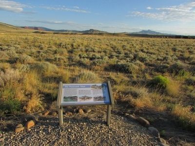
The Panoramic View Marker
SHOWN IN SOURCE-SPECIFIED ORDER
| | Look to your left and you will see the canyon cut by the Shoshone River. The mountain to the left of the canyon is Cedar Mountain. To the right of Shoshone Canyon you can see Rattlesnake Mountain. The red butte (to the right of Rattlesnake Mt.) is . . . — — Map (db m87565) HM |
| | Cedar Mountain, the mountain in front of you to the left of the canyon, was known to the Crow Indians as “the mountain of spirits.” Early settlers told of finding Indian tree burials on its northeast slope. Unfortunately, those sites . . . — — Map (db m87566) HM |
| | Off in the distance in front of you, a large red butte lies against a much larger mountain, Rattlesnake Mountain. Flowing down the valley is Trail Creek, named for the ancient Indian trail that crosses the Shoshone River at the Indian ford in the . . . — — Map (db m87571) HM |
| | On both sides of the Shoshone River there are many circles made of stones built by the Indians who frequented this area. Some of the sites are simply circles with no doorways, believed to be religious symbols associated with the circle of life or . . . — — Map (db m87575) HM |
| | The rocky ridge you are now crossing marks the southern edge of Lee Street, one of the original roads of Cody City. Wagon ruts, phone wires and rock cairn lot markers have been found along its path. In memory of Jerry Housel and Mary Elaine Housel . . . — — Map (db m87580) HM |
| | Here on the prairie there are still visible remnants of several old wagon trails dating back to Cody City in the late 1800’s. The first buildings of Cody City were constructed on the nearby plain to the west, although the town was supposed to be . . . — — Map (db m87586) HM |
May. 5, 2024