Fort Smith in Sebastian County, Arkansas — The American South (West South Central)
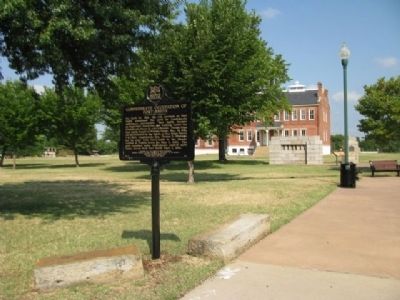
Confederate [and] Union Occupation of Fort Smith
Inscription.
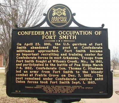
On April 23, 1861, the U.S. garrison at Fort Smith abandoned the post as Confederate militiamen approached. Fort Smith became an important recruiting and training center for Confederate forces in west Arkansas. Troops from Fort Smith fought at Wilson's Creek, Mo., in 1861, and participated in the battle of Pea Ridge March 7-8, 1862. Confederate Gen. Thomas C. Hindman led an army from Fort Smith to the bloody combat at Prairie Grove on Dec. 7, 1862. The post remained under Confederate control until Union forces took Fort Smith Sept. 1, 1863.
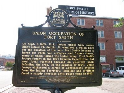
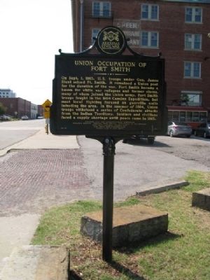
On Sept. 1, 1863, U.S. troops under Gen. James Blunt seized Ft. Smith. It remained a Union post for the duration of the war. Fort Smith became a haven for white war refugees and former slaves, many of whom joined the Union army. Fort Smith troops fought in the 1864 Camden Expedition, but most local fighting focused on guerrilla units infesting the area. In the summer of 1864, Union troops withstood a series of Confederate attacks from the Indian Territory. Soldiers and civilians faced a supply shortage until peace came in 1865.
Preserve America, National Park Service, Department of the Interior
Fort Smith National Historic Site
Fort Smith Noon Exchange Club
Rotary Club of Fort Smith
Erected 2011 by Arkansas Civil War Sesquicentennial Commission. (Marker Number 15.)
Topics and series. This historical marker is listed in this topic list: War, US Civil. In addition, it is included in the Arkansas Civil War Sesquicentennial Commission, and the Rotary International series lists. A significant historical month for this entry is September 2012.
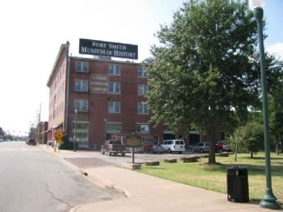
Location. 35° 23.281′ N, 94° 25.723′ W. Marker is in Fort Smith, Arkansas, in Sebastian County. Marker is on Rogers Avenue, on the right when traveling south. Touch for map. Marker is at or near this postal address: 320 Rogers Avenue, Fort Smith AR 72901, United States of America. Touch for directions.
Other nearby markers. At least 8 other markers are within walking distance of this marker. Welcome to Fort Smith (within shouting distance of this marker); First Butterfield Overland Mail Coach (within shouting distance of this marker); The Commissary Storehouse (within shouting distance of this marker); Barracks, Courthouse, Jail (within shouting distance of this marker); Clues from the Past (within shouting distance of this marker); The Flagstaff (about 400 feet away, measured in a direct line); Meeting of Nations (about 400 feet away); Old Federal Building (about 400 feet away). Touch for a list and map of all markers in Fort Smith.
Credits. This page was last revised on July 13, 2022. It was originally submitted on July 28, 2012, by Denise Boose of Tehachapi, California. This page has been viewed 1,012 times since then and 55 times this year. Photos: 1. submitted on January 21, 2016, by William Fischer, Jr. of Scranton, Pennsylvania. 2, 3, 4, 5, 6. submitted on July 28, 2012, by Denise Boose of Tehachapi, California. • Craig Swain was the editor who published this page.
