On Alaska Ave (National Highway 2) near 8th Street, in the median.
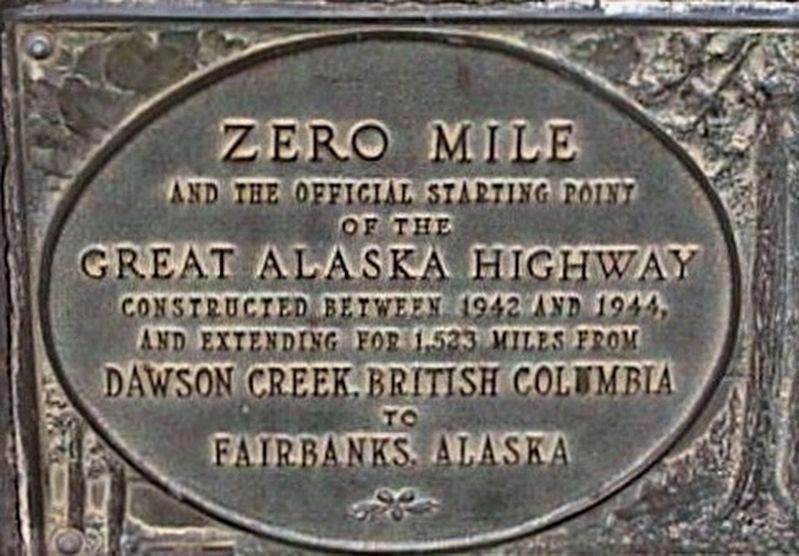
Constructed in just 8 months in 1942,
this 2,450 kilometre highway provided
an essential transportation link to the
northwest of North America during
the Second World War, and has since
remained a major . . . — — Map (db m135256) HM
Near Canyon Drive, 0.5 kilometers east of Ski Hill Road, on the left when traveling east.
Seeking a route to the Pacific Ocean, this resolute fur trader and explorer, with his party of 9 men and a frail bark canoe, portaged nearby in May 1793 to avoid the awesome Peace River Canyon. On July 20 he reached tidewater. By this unrivalled . . . — — Map (db m188028) HM
On John Hart Highway (Provincial Highway 97) 0.2 kilometers west of 223 Road, on the left when traveling west.
Once called “The Beaver Plains”, this townsite was named in honour of Dr. G.M. Dawson, outstanding Canadian geologist and scientist, whose expeditions in B.C. covered almost every field of natural history. His geodetic surveys of 1879 reported the . . . — — Map (db m188018) HM
On Alaska Highway (Provincial Highway 97) 0.6 kilometers north of Pingel Creek Road, on the right when traveling north.
In 1793 Alexander Mackenzie and North West Company adventurers discovered this route through the Rocky Mountains. During 1805-08 Simon Fraser built forts and trading posts west of the mountains. Furs of the Pacific watershed began moving eastward. . . . — — Map (db m187958) HM
On Don Phillips Way (Provincial Highway 29) 0.8 kilometers west of Heritage Highway (Provincial Highway 52), on the left when traveling west.
In the summer of 2000, two young boys tubing down Flatbed Creek stumbled upon ankylosaur tracks - the longest dinosaur trackway in British Columbia at the time. This discovery was a turning point in the development of Tumbler Ridge and the Peace . . . — — Map (db m187874) HM