Near Drinkwater Road east of Trans-Canada Highway (Provincial Highway 1), on the right when traveling east.
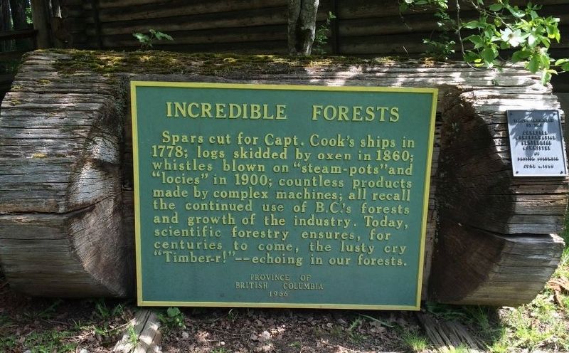
Spars cut for Capt. Cook's ships in 1778; logs skidded by oxen in 1860; whistles blown on “steam-pots” and “locies” in 1900; countless products made by complex machines; all recall the continued use of B.C.'s forests and growth of the industry. . . . — — Map (db m187995) HM
On 1st Avenue at Roberts Street, on the right when traveling south on 1st Avenue.
An “instant” town of the past. In 1898 James Dunsmuir, the coal baron, moved buildings by rail from Wellington to establish this coal shipping port. Nearby copper mines added a smelter in 1902, but only pilings mark that site. Railroad logging aided . . . — — Map (db m187985) HM
On 1st Avenue at Symonds Street, on the right when traveling south on 1st Avenue.
The Oregon Treaty of 1846 set the United States and British North American border at the 49th parallel from Lake of the Woods, Ontario westward to Vancouver, British Columbia. Vancouver Island, which is intersected by the 49th parallel at Ladysmith . . . — — Map (db m187891) HM