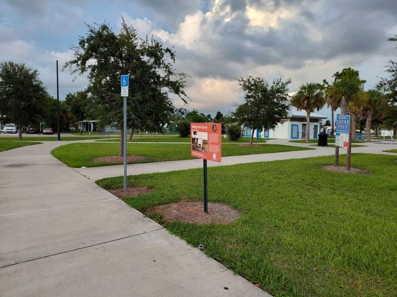
On Elkcam Boulevard at McGuire Avenue, on the right when traveling north on Elkcam Boulevard.
Arthur C. and Patti Frizzell were ranchers and entrepreneurs who brought in the first Brahman (or Brahma) cattle to the area to improve their herd. They owned over 80,000 acres of land for cattle, turpentine, lumber, and various businesses in . . . — — Map (db m256035) HM
On Cooper Street at East McKenzie Street, on the right when traveling north on Cooper Street.
Originally named the Punta Gorda High School, this building was the first dedicated high school for the newly created Charlotte County (1921), replacing the previous 1907 Punta Gorda Grammar and High School. Construction of the school began in 1926 . . . — — Map (db m215977) HM
On Indian Springs Cemetery Road at Ferncroft Avenue, on the left when traveling south on Indian Springs Cemetery Road.
Indian Spring Cemetery, also called Indian Springs, was created in 1886 on land donated by James L. Sandlin (1858-1903), who settled on Alligator Creek in 1884. Additions were recorded in 1891, 1931, 1974 and 1975. The name "Indian Spring" came from . . . — — Map (db m189588) HM
Near Gasparilla Road (County Route 771) 0.1 miles south of South McCall Road (Florida Route 776).
The Placida Bunk House was built about 1907 by the Charlotte Harbor & Northern Railroad to house their employees. The line was laid to transport phosphate to docks at South Boca Grande on Gasparilla Island. Several families called the building home, . . . — — Map (db m152668) HM
On Scott Avenue just north of Duncan Road (U.S. 17), on the left when traveling north.
Lt. Carl Bailey Cemetery has served this area’s African-American community as a final resting place for over 120 years. The cemetery was called the Cleveland Cemetery, established in the 1880s on land owned by New York investor W. Irving Scott. The . . . — — Map (db m151119) HM
Near Dr Martin Luther King Jr Boulevard at East Virginia Avenue, on the left when traveling north.
The Bailey Brothers served the United States of America honorably World War II, the Korean War and the Vietnam War
Archie and Josephine Bailey were married in 1905 and made Punta Gorda their home. They raised their large family in their . . . — — Map (db m249137) HM
On Kerrigan Circle 0.1 miles west of El Jobean Road (Florida Route 776), on the left when traveling south.
During the American Civil War in late 1863, Union forces and "refugee rangers" encountered local combatants in a brief skirmish on the eastern shore of the Myakka River near today's El Jobean. It is the only recorded Civil War skirmish within the . . . — — Map (db m151053) HM
On Taylor Street at Olympia Avenue, on the right when traveling north on Taylor Street.
Charlotte County was created in 1921, after citizens had pushed for 34 years to divide DeSoto County, and Punta Gorda was the new county seat. After meeting in rented quarters, the Board of County Commissioners voted in 1927 to plan a new building . . . — — Map (db m189589) HM
On Taylor Road at Carmalita Street, on the right when traveling south on Taylor Road.
Plans to build the railroad depot in Punta Gorda began in 1928. Although the trains carried passengers, the main purpose was for shipping fish to northern markets. The Punta Gorda depot is the only remaining one of this style built by the Atlantic . . . — — Map (db m167353) HM
On Lemon Bay Road just east of Riverside Drive, on the left when traveling west.
1891: Colonel James M. Lewis built a hunting lodge near here on Deer Creek and named it "New Point Comfort" after his boyhood home, Old Point Comfort. in Virginia.
1893: The Gottfried family from Milwaukee settled on Deer Creek, now named . . . — — Map (db m255693) HM
On Laurens Street SW near The Alley, on the right when traveling north.
Aiken, chartered in 1835 and the county seat of Aiken County since its creation in 1871, was an early stop on the railroad line from Charleston to Hamburg. It was named for William Aiken (1779–1831), the first president of the S.C. Canal and . . . — — Map (db m9640) HM
On David Bruce Avenue (Virginia Route 40) east of Legrande Avenue ( Route 47), on the right when traveling east.
(Preface) From 1861 To 1865, Our country was torn apart by a Civil War that pitted North against South, brother against brother, father against son, neighbor against neighbor. The impact of the war and its aftermath are still felt today as . . . — — Map (db m262872) HM
Thin black lines indicate changes in relevance. Between each pair of lines entries are ordered geographically but all have the same relevance.
* Inflectional forms of words are their plurals, singulars, and possessives as well as gramatical tenses and similar variations.