Marker Logo HMdb.org THE HISTORICAL
MARKER DATABASE
“Bite-Size Bits of Local, National, and Global History”


5 entries match your criteria.  


Historical Markers and War Memorials in Asan, Guam

 
Attack, Occupation, Liberation Marker detail image, Touch for more information
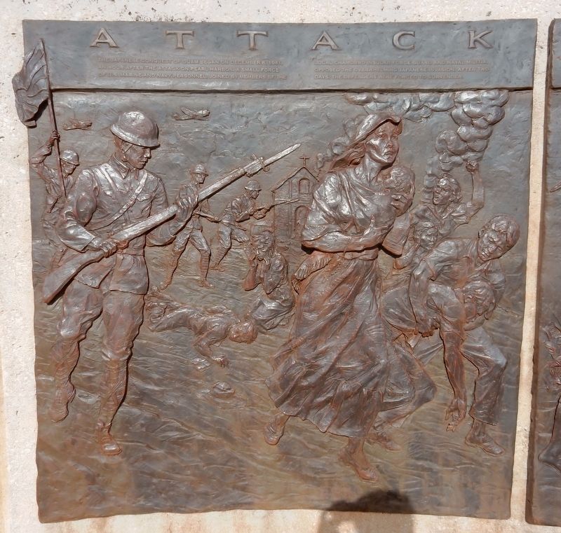
Courtesy of Thomas P. Martin
Attack, Occupation, Liberation Marker detail
1 Guam, Asan — Attack, Occupation, Liberation
Near Highway 6, 0.2 miles south of Turner Road, on the right when traveling south.
2 Guam, Asan — Banzai Charges
Near Highway 6, 0.2 miles south of Turner Road, on the right when traveling south.
3 Guam, Asan — Guam 1941-1944
Near Highway 6, 0.2 miles south of Turner Road, on the right when traveling south.
4 Guam, Asan — The Inland Offensive
Near Highway 6, 0.2 miles south of Turner Road, on the right when traveling south.
5 Guam, Asan — War in the Pacific National Historical Park
Near Marine Corps Drive (Highway 1) west of Jose Leon Guerrero Street, on the right when traveling west.


CeraNet Cloud Computing sponsors the Historical Marker Database.
This website earns income from purchases you make after using our links to Amazon.com. We appreciate your support.
Paid Advertisement
Apr. 30, 2024