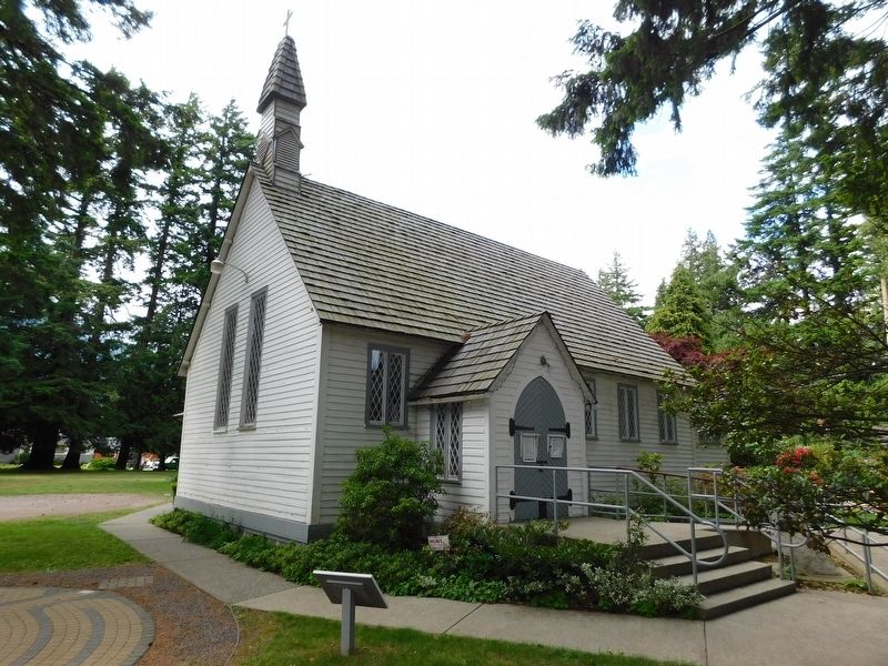
On Fraser Avenue north of Park Avenue, on the right when traveling north.
Built in 1861, Christ Church is a fine example of the mid-19th-century revival of mediaeval Gothic forms in religious
architecture. This use of traditional models reinforced the
broader role of the Anglican church as a stabilizing . . . — — Map (db m303143) HM
Near Crowsnest Highway, on the right when traveling west.
Early Saturday morning, January 9, 1965, an enormous landslide descended into this valley of the Nicolum Creek, destroying about 3 km of the Hope-Princeton Highway.
Apparently triggered by a minor earthquake, the slide, consisting of more than 46 . . . — — Map (db m161724) HM
On Sumallo River Road 0.05 kilometers south of Crowsnest Highway (Provincial Highway 3), on the right when traveling south.
In 1942, over 21,000 Japanese Canadians were unjustifiably removed from British Columbia's coast. Tashme internment camp held over 2,644 men, women, and children who lived in 347 crude tarpaper shacks. Despite horrible living conditions, the . . . — — Map (db m187902) HM