Near Point Prim Road (Prince Edward Island Route 209) 11 kilometers west of Trans-Canada Highway (National Route 1).
English:
Despite its initial success, the Prince Edward Island Steam Navigation Company and its vessel, the St. George, ran into difficulties. Even with investments from New Brunswick and Nova Scotia, steamboats were . . . — — Map (db m140249) HM
Near Point Prim Road (Prince Edward Island Route 209) 11 kilometers west of Trans-Canada Highway (National Route 1).
English:
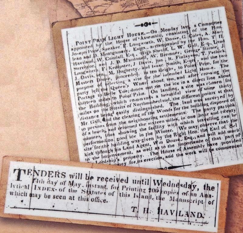
Prince Edward Island's contribution to Nova Scotia's lighthouses inspired the question: What about building a lighthouse here?
Petitions for lighthouses began to appear before government by the late 1830s. Concerned . . . — — Map (db m140246) HM
Near Point Prim Road (Prince Edward Island Route 209) 11 kilometers west of Trans-Canada Highway (National Route 1).
English:
At the same time that the Island was grappling with the issue of lighthouses, it found itself dealing with an issue of a different sort: Mail delivery.
Mail delivery was very important, representing the Island's . . . — — Map (db m140247) HM
Near Point Prim Road (Prince Edward Island Route 209) 11 kilometers west of Trans-Canada Highway (National Route 1).
English:
Late in the summer of 1864, two events descended upon the city of Charlottetown. One was a circus; the other, a political conference. Of the two, it was the circus that captured the attention of Islanders. But it was the . . . — — Map (db m140250) HM
Near Point Prim Road (Prince Edward Island Route 209) 11 kilometers west of Trans-Canada Highway (National Route 1).
English:
Imagine being aboard a ship on a dark, stormy night. The wind is howling fiercely, pushing large waves over the sides of your vessel. You are at the mercy of the elements. Picture a lack of navigational aids, creating a . . . — — Map (db m140245) HM