On 1st Street South just south of 5th Avenue, on the left when traveling south.
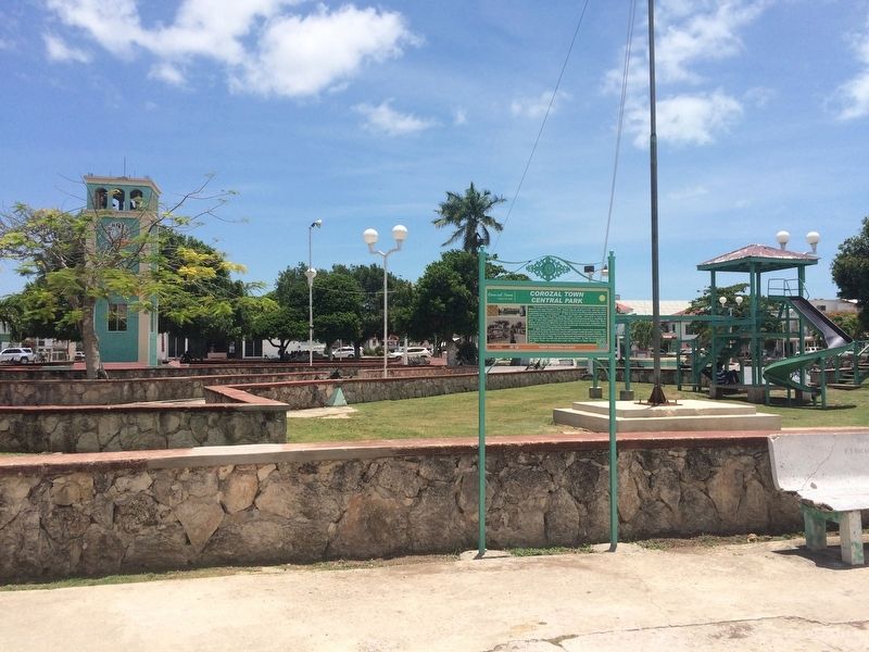
Corozal Town Central ParkThe Central Plaza of Corozal Town has been used for various activities and events since the town was founded in 1849. Social, cultural, sporting events and even a brief occupation in 1870 by Marcus Canul, General of the . . . — — Map (db m105064) HM
On 1st Street South just south of 5th Avenue, on the right when traveling south.
Corozal Town HallIn 1952 the Corozal Town Hall was constructed. It was financed by the Baron Bliss Trust Fund. The large concrete building dominated the physical landscape with only two other concrete structures, the Catholic Church and the . . . — — Map (db m105070) HM
On 5th Avenue at 1st Street North, on the left when traveling east on 5th Avenue.
Fort Barlee Fort Barlee was constructed in Corozal Town by Lieutenant Governor Frederick Palgrave Barlee (pictured here) in the late 1870's. The fort was built to protect British
interests and Yucatecan settlers in Corozal during the latter . . . — — Map (db m105062) HM
On 2nd Street South just south of 4th Avenue, on the right when traveling south.
Her Majesty’s PrisonThe mid to late 1800's was unquestionably a period of unrest and instability along the Rio Hondo and Corozal Town. A substantial migration of Yucatecos
fleeing the Caste Wars in Mexico led to an increase in population and . . . — — Map (db m105069) HM
On 1st Avenue at 2nd Street South, on the left when traveling west on 1st Avenue.
House of Culture/Public MarketArriving from England by ship in 1885, the cast iron frame of an intended market was assembled and a building was constructed along the shoreline close to the public pier. Inaugurated in 1886, the Corozal Town . . . — — Map (db m105090) HM
On 1st Street South just south of 4th Avenue, on the left when traveling south.
Parish Office/Priest’s Residence/Xavier College
The priest's residence or "El Convento" was constructed in early the 1890's. Its construction is attributed to Father Gillett who was one of the English Jesuit priests who came to Belize in the . . . — — Map (db m105066) HM
On 1st Avenue at 1st Street South, on the right when traveling east on 1st Avenue.
Schofield ResidenceThe Schofield residence was constructed in the early 1880's when mature mahogany was still thriving in the forests of northern Belize which ensured its longevity into the 21st century. It has survived many hurricanes . . . — — Map (db m105068) HM