Marker Logo
THE HISTORICAL
MARKER DATABASE
“Bite-Size Bits of Local, National, and Global History”
Corozal Town, Corozal, Belize — Central America
 

Corozal Town Central Park

Corozal Town Historical Walk
 
 
Corozal Town Central Park Marker image. Click for full size.
Photographed by J. Makali Bruton, May 18, 2017
1. Corozal Town Central Park Marker
Inscription.
Corozal Town Central Park
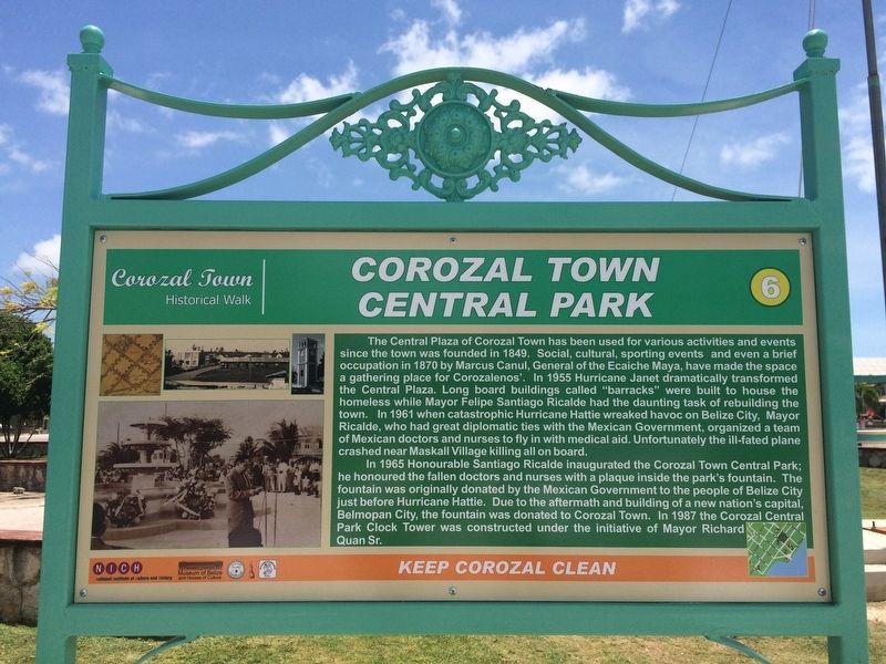
The Central Plaza of Corozal Town has been used for various activities and events since the town was founded in 1849. Social, cultural, sporting events and even a brief occupation in 1870 by Marcus Canul, General of the Ecaiche Maya, have made the space a gathering place for Corozalenos'. In 1955 Hurricane Janet dramatically transformed the Central Plaza. Long board buildings called "barracks" were built to house the homeless while Mayor Felipe Santiago Ricalde had the daunting task of rebuilding the town. In 1961 when catastrophic Hurricane Hattie wreaked havoc on Belize City, Mayor Ricalde, who had great diplomatic ties with the Mexican Government, organized a team of Mexican doctors and nurses to fly in with medical aid. Unfortunately the ill-fated plane crashed near Maskall Village killing all on board.

In 1965 Honourable Santiago Ricalde inaugurated the Corozal Town Central Park; he honoured the fallen doctors and nurses with a plaque inside the park's fountain. The fountain was originally donated by the Mexican Government to the people of Belize City just before Hurricane Hattie. Due to the
Paid Advertisement
Click or scan to see
this page online
aftermath and building of a new nation's capital, Belmopan City, the fountain was donated to Corozal Town. In 1987 the Corozal Central Park Clock Tower was constructed under the initiative of Mayor Richard Quan Sr.
 
Erected by National Institute of Culture and History (NICH). (Marker Number 6 of 7.)
 
Topics. This historical marker is listed in these topic lists: Charity & Public WorkDisastersMan-Made FeaturesWars, Non-US. A significant historical year for this entry is 1849.
 
Location. 18° 23.491′ N, 88° 23.211′ W. Marker is in Corozal Town, Corozal. It is on 1st Street South just south of 5th Avenue, on the left when traveling south. Touch for map. Marker is in this post office area: Corozal Town, Corozal 7M0ZP L1XPD, Belize. Touch for directions.

Regionally, it is in North America, Central America, Mesoamerica, the Western Hemisphere, and the Anglosphere. Historically, it finds itself in what was once New Spain, a Spanish colony, and specifically a British colony.

Other nearby markers. At least 8 other markers are within 14 kilometers of this marker, measured as the crow flies: Corozal Town Hall
Corozal Town Central Park Marker image. Click for full size.
Photographed by J. Makali Bruton, May 18, 2017
2. Corozal Town Central Park Marker
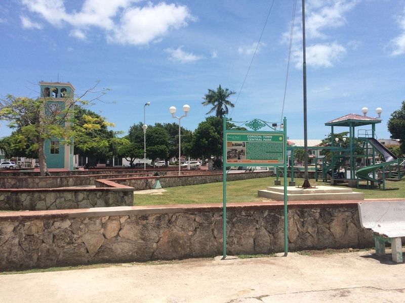
The fountain and clock tower mentioned in the marker text can be seen in the background in this view of the central park.
(a few steps from this marker); Felipe Santiago Ricalde (within shouting distance of this marker); Fort Barlee (about 90 meters away, measured in a direct line); Parish Office/Priest’s Residence/Xavier College (about 120 meters away); Her Majesty's Prison (about 150 meters away); House of Culture/Public Market (about 180 meters away); Schofield Residence (about 180 meters away); Mr. Ignacio Filiberto Sabido Padilla (approx. 14.4 kilometers away in Mexico). Touch for a list and map of all markers in Corozal Town.
 
 
Credits. This page was last revised on July 4, 2017. It was originally submitted on July 4, 2017, by J. Makali Bruton of Washington, District of Columbia. This page has been viewed 714 times since then and 20 times this year. Photos:   1, 2. submitted on July 4, 2017, by J. Makali Bruton of Washington, District of Columbia.

m=105064

CeraNet Cloud Computing sponsors the Historical Marker Database.
This website earns income from purchases you make after using our links to Amazon.com. We appreciate your support.
Paid Advertisement
Aug. 2, 2026