Marker Logo HMdb.org THE HISTORICAL
MARKER DATABASE
“Bite-Size Bits of Local, National, and Global History”


6 entries match your criteria.  


Related Historical Markers

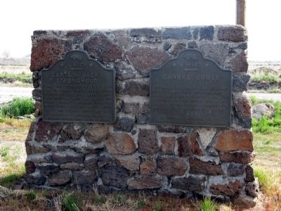
Markers located at and near Captain Jack's Stronghold in California.
 
Captain Jack's Stronghold Marker image, Touch for more information
By Syd Whittle, May 10, 2008
Captain Jack's Stronghold Marker
SHOWN IN SOURCE-SPECIFIED ORDER
1 California, Modoc County, Newell — 9 — Captain Jack’s Stronghold← 11 Miles
On State Highway 139,, 0.2 miles south of Glendale Street, on the right when traveling south.
2 California, Siskiyou County, Tulelake — Lava FortressCaptain Jack's Stronghold
Near Monument Rim Road.
3 California, Siskiyou County, Tule Lake — The Road to the Stronghold
On County Route 120 near Hill Road (County Route 10), on the left when traveling west.
4 California, Siskiyou County, Tulelake — Last Meeting of the Peace CommissionLava Beds National Monument — National Park Service, U.S. Department of the Interior —
On Hill Road.
5 California, Siskiyou County, Tule Lake — Shore of Tule Lake
Near County Route 120 near Hill Road (County Route 10), on the left when traveling west.
6 California, Modoc County, Newell — 110 — Canby’s Cross
On California Route 139,, 0.2 miles Glendale Street, on the right when traveling south.
 
 
CeraNet Cloud Computing sponsors the Historical Marker Database.
This website earns income from purchases you make after using our links to Amazon.com. We appreciate your support.
Paid Advertisement
May. 19, 2024