3 entries match your criteria.
Related Historical Markers
By Bernard Fisher, September 1, 2014
Early History of Suffolk Marker
SHOWN IN SOURCE-SPECIFIED ORDER
| Near North Main Street (Virginia Route 32) north of East Constance Road (Business U.S. 460), on the right when traveling north. |
| | A community developed here in the 1720s around John Constant's wharf, dwelling, and tobacco warehouse. The Virginia House of Burgesses chartered the town of Suffolk in 1742. It was incorporated as a town in 1808 and as a city in 1910; in 1974 it . . . — — Map (db m76803) HM |
| On Western Avenue at Church Street, on the right when traveling west on Western Avenue. |
| | Here stood the Colonial Suffolk Church, a large, cross-shaped, brick building, erected in 1753 as the second parish church of Upper Parish, Nansemond County, and the first house of worship in the town of Suffolk. It survived the burning of Suffolk . . . — — Map (db m76804) HM |
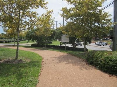
| Near East Constance Road (Business U.S. 58) east of North Main Street (Virginia Route 32), on the right when traveling east. |
| | Cedar Hill Cemetery sits on the site of a farm owned by the John Constant family in the early 1700’s. In 1802, the Town of Suffolk purchased 2½ acres of the farm to build a community meeting house as a shared house of worship for both blacks . . . — — Map (db m103516) HM |
May. 19, 2024