4 entries match your criteria.
Related Historical Markers
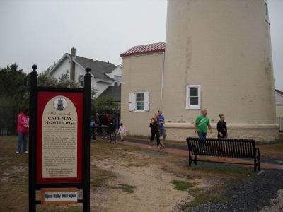
Cape May Lighthouse
By Bill Coughlin, August 18, 2010
Cape May Lighthouse Marker
SHOWN IN SOURCE-SPECIFIED ORDER
| On Lincoln Avenue. Reported permanently removed. |
| |
For some 180 years, a lighthouse beacon has stood here at the southern tip of New Jersey, guarding the entrance to Delaware Bay. The present tower was constructed in 1859. Standing 157½ feet tall, it is the third lighthouse on this site, . . . — — Map (db m114572) HM |
| Near Light House Ave (County Route 629) at Lehigh Avenue. |
| |
From the time the current lighthouse was built in 1859 to the time it was electrified around 1933, four keepers, their assistants, and their families lived and worked on this landscape by the sea.
The keepers and their periods of service . . . — — Map (db m114569) HM |
| On Light House Avenue, on the left when traveling south. Reported permanently removed. |
| |
Primary seacoast lights were located to warn mariners of their proximity to land, the presence of navigational dangers, and to help set their course. By 1852, however, lighthouses and lightships often looked so much alike that it was difficult to . . . — — Map (db m114571) HM |
| On Light House Avenue, on the left when traveling south. Reported damaged. |
| |
This structure was built in 1893 to house the kerosene used to power the light. Until 1893, the Lighthouse’s oil was stored in the vestibule house at the entrance to the tower. Moving it to a separate building reduced the risk of fire in the . . . — — Map (db m114573) HM |
Apr. 29, 2024