Fort Hunt in Fairfax County, Virginia — The American South (Mid-Atlantic)
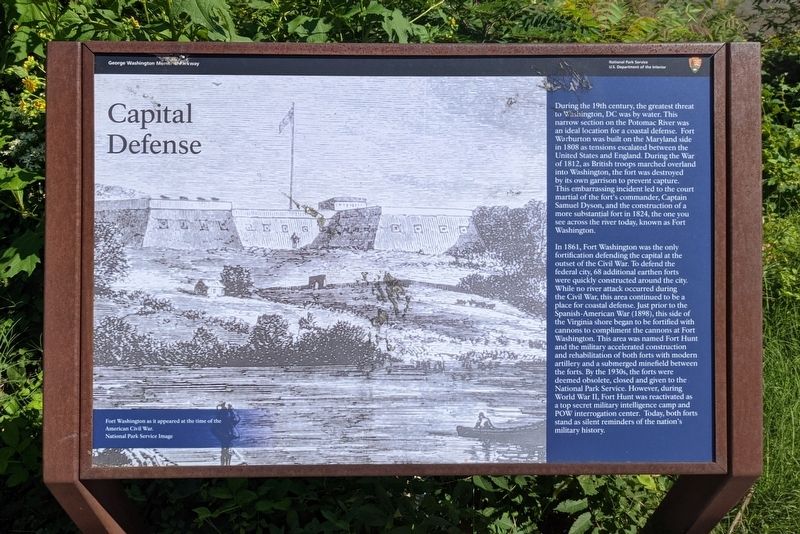
Capital Defense
George Washington Memorial Parkway
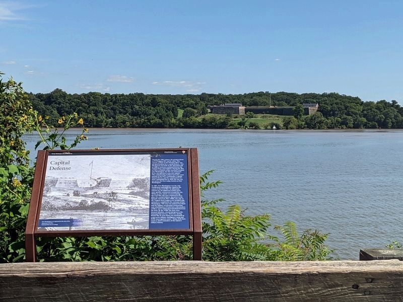
During the 19th century, the greatest threat to Washington, DC was by water. This narrow section on the Potomac River was an ideal location for a coastal defense. Fort Warburton was built on the Maryland side in 1808 as tensions escalated between the United States and England. During the War of 1812, as British troops marched overland into Washington, the fort was destroyed by its own garrison to prevent capture. This embarrassing incident led to the court martial of the fort's commander, Captain Samuel Dyson, and the construction of a more substantial fort in 1824, the one you see across the river today, known as Fort Washington.
In 1861, Fort Washington was the only fortification defending the capital at the outset of the Civil War. To defend the federal city, 68 additional earthen forts were quickly constructed around the city. While no river attack occurred during the Civil War, this area continued to be a place for coastal defense. Just prior to the Spanish-American War (1898), this side of the Virginia shore began to be fortified with cannons to compliment the cannons at Fort Washington. This area was named Fort Hunt and the military accelerated construction and rehabilitation of both forts with modern artillery and a submerged minefield between the forts. By the 1930s, the forts were deemed obsolete, closed and given to the National Park Service. However, during World War II, Fort Hunt was reactivated as a top secret military intelligence camp and POW interrogation center. Today, both forts stand as silent reminders of the nation's military history.
(caption)
Fort Washington as it appeared at the time of the American Civil War. National Park Service Image
Erected by National Park Service, U.S. Department of the Interior.
Topics. This historical marker is listed in these topic lists: Forts and Castles • War of 1812 • War, US Civil • War, World II. A significant historical year for this entry is 1808.
Location. 38° 43.024′ N, 77° 2.681′ W. Marker is in Fort Hunt, Virginia, in Fairfax County. Marker is at the intersection of George Washington Memorial Parkway and Fort Hunt Road, on the right when traveling north on George Washington Memorial Parkway. Touch for map. Marker is at or near this postal address: 822 Emerald Dr, Alexandria VA 22308, United States of America. Touch for directions.
Other nearby markers. At least 8 other markers are within walking distance of this marker. Battery Robinson (approx. 0.2 miles away); Protecting America's Legacy (approx. 0.2 miles away); Battery Sater (approx. 0.2 miles away); a different marker also named Battery Sater (approx. ¼ mile away); Beyond What You See Today
(approx. 0.4 miles away); Battery Mount Vernon (approx. 0.4 miles away); Fort Hunt Park (approx. 0.4 miles away); P.O. Box 1142 (approx. 0.4 miles away). Touch for a list and map of all markers in Fort Hunt.
Related marker. Click here for another marker that is related to this marker. Old Marker At This Location titled "Fort Washington—The Capital’s Guardian".
Credits. This page was last revised on January 27, 2022. It was originally submitted on September 4, 2021, by Bernard Fisher of Richmond, Virginia. This page has been viewed 153 times since then and 23 times this year. Photos: 1, 2. submitted on September 4, 2021, by Bernard Fisher of Richmond, Virginia.

