4 entries match your criteria.
Related Historical Markers
The Conestoga Indian Massacre of 1763
By Cosmos Mariner, August 27, 2018
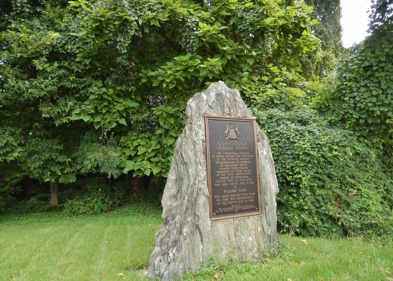
Conestoga Indian Town Marker (wide view; showing large boulder upon which marker is mounted)
SHOWN IN SOURCE-SPECIFIED ORDER
| On Safe Harbor Road at Indian Marker Road, on the right when traveling north on Safe Harbor Road. |
| | The Conestoga Indians
in origin largely the survivors
of the defeated ancient
Susquehannas or Minquas
of Iroquoian stock
located their village
variously on these lands
in the Penn Proprietary
Manor of Conestoga
chiefly . . . — — Map (db m161269) HM |
| On River Road (Pennsylvania Route 3030) 0.1 miles south of Safe Harbor Road, on the right when traveling south. |
| | The Conestoga Indians lived in scattered settlements along this stream. They were the last of the once mighty Susquehannocks. Their final location was the Conestoga Indian Town which was along the road leading to Creswell. William Penn visited the . . . — — Map (db m160253) HM |
| On West King Street west of North Prince Street (State Highway 462), on the left when traveling east. Reported missing. |
| | The Lancaster jail was located a half block to the north from 1753 to 1851. The last remaining Conestoga Indians were held here in protective custody in 1763. They were killed by a vigilante group, the Paxton Boys. No arrests were made. — — Map (db m186147) HM |
| On North Water Street north of West King Street, on the right when traveling north. |
| | Site of Conestoga Indian Massacre December 27, 1763 — — Map (db m122636) HM |
Apr. 26, 2024