2 entries match your criteria.
Related Historical Markers
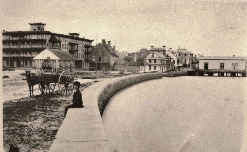
St. Augustine Seawall
St. Augustine Historical Society
Marker detail: View from St. Augustine marina facing north to the Plaza de Constitución circa 1880
SHOWN IN SOURCE-SPECIFIED ORDER
| On Avenida Menendez north of Bravo Lane, on the right when traveling north. |
| | The Seawall in St. Augustine History
St. Augustine's history has been shaped by the sea since its founding in 1565. Over the centuries, colonial explorers, pirates, and seafaring merchants have found their way into Matanzas Bay, known today as . . . — — Map (db m127500) HM |
| On Menendez Avienda at Bravo Lane, on the right when traveling north on Menendez Avienda. |
| | This portion of the St. Augustine sea wall, extending from King Street to the south end of St. Francis Barracks, was constructed during the period 1833 to 1844. The coquina wall with granite top served as protection for the homes and businesses on . . . — — Map (db m127638) HM |
May. 17, 2024