Marker Logo HMdb.org THE HISTORICAL
MARKER DATABASE
“Bite-Size Bits of Local, National, and Global History”


5 entries match your criteria.  


Related Historical Markers

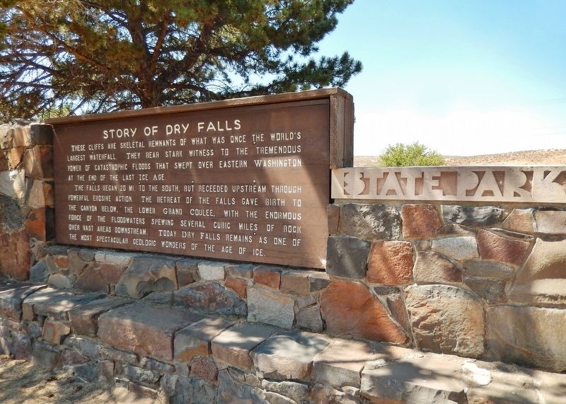
Sun Lakes-Dry Falls State Park
 
Story of Dry Falls Marker (<i>wide view</i>) image, Touch for more information
By Cosmos Mariner, July 31, 2015
Story of Dry Falls Marker (wide view)
SHOWN IN SOURCE-SPECIFIED ORDER
1 Washington, Grant County, Coulee City — 27 — Story of Dry Falls
Near Park Lake Road Northeast (Washington Route 17) 2 miles south of U.S. 2, on the left when traveling south.
2 Washington, Grant County, Coulee City — Dry Falls
Near Park Lake Road Northeast (Washington Route 17) 2 miles south of U.S. 2, on the left when traveling south.
3 Washington, Grant County, Coulee City — World's Greatest Waterfall... Without Water!
Near Park Lake Road Northeast (Washington Route 17) 2 miles south of U.S. 2, on the left when traveling south.
4 Washington, Grant County, Coulee City — In the Path of Cataclysmic Floods
Near Park Lake Road Northeast (Washington Route 17) 2 miles south of U.S. 2, on the left when traveling south.
5 Washington, Grant County, Coulee City — Explore Massive Floodscapes!
Near Park Lake Road Northeast (Washington Route 17) 2 miles south of U.S. 2, on the left when traveling south.


CeraNet Cloud Computing sponsors the Historical Marker Database.
This website earns income from purchases you make after using our links to Amazon.com. We appreciate your support.
Paid Advertisement
May. 19, 2024