17 entries match your criteria.
Related Historical Markers
To better understand the relationship, study each marker in the order shown.
By Robert L Weber, June 8, 2012
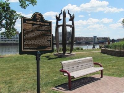
Packers Heritage Trail Marker, Fox River and artwork
SHOWN IN SOURCE-SPECIFIED ORDER
| Near Dousman Street (U.S. 141) at Museum Place, on the right when traveling east. |
| Near North Washington Street south of Mains Street (U.S. 141), on the right when traveling south. |
| On Cherry Street, on the right when traveling west. |
| On Pine Street at North Adams Street, on the right when traveling west on Pine Street. |
| On North Adams Street at East Walnut Street (Wisconsin Highway 29), on the left when traveling south on North Adams Street. |
| On East Walnut Street (State Highway 29) at South Washington Street, on the right when traveling east on East Walnut Street. |
| On South Washington Street at Crooks Street, on the right when traveling south on South Washington Street. |
| On South Adams Street at Crooks Street, on the right when traveling north on South Adams Street. |
| On South Adams Street at Doty Street, on the right when traveling north on South Adams Street. |
| On South Jefferson Street at Doty Street, on the right when traveling south on South Jefferson Street. |
| On South Jefferson Street south of East Walnut Street (Wisconsin Highway 29), on the right when traveling north. |
| On East Walnut Street (State Highway 29) at North Madison Street, on the right when traveling west on East Walnut Street. |
| On North Baird Street at East Walnut Street, on the right when traveling north on North Baird Street. |
| On North Irwin Avenue south of University Avenue (Wisconsin Highway 54), on the right when traveling south. |
| Near Dousman Street (U.S. 141) east of North Broadway Street (U.S. 141). |
| On North Baird Street at Cherry Street, on the right when traveling north on North Baird Street. |
| Near Riverside Drive north of West Allouez Avenue, on the left when traveling north. |
May. 19, 2024