3 entries match your criteria.
Related Historical Markers
By Duane and Tracy Marsteller, May 16, 2020
Joseph Roark Homestead Marker
SHOWN IN SOURCE-SPECIFIED ORDER
| On Birchwood Pike (County Road 605) 0.1 miles north of Grasshopper Road, on the right when traveling north. |
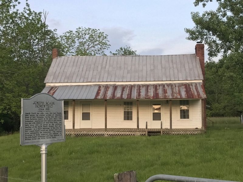
| | Joseph Roark and wife, Juda Ann Carr Roark, were among the original settlers of Cherokee lands of East Tennessee, moving into this area from Claiborne County in the early 1830's. This homestead, constructed with walls of split walnut logs and with . . . — — Map (db m150441) HM |
| On Birchwood Pike (County Road 605) 0.2 miles south of Eldridge Road, on the left when traveling south. |
| | Joseph Roark gave this site in Wilderness Indian Territory for this Church where many worshiped God. Used as a hospital during Civil War, it was also the center of Salem Academy. A monument to Thos. Palmer and Wm. Moore, soldiers of the Revolution, . . . — — Map (db m150439) HM |
| On Birchwood Pike (Tennessee Route 312) 0.2 miles south of Sam Smith Road, on the right when traveling south. |
| | Located one mile northwest, the cemetery contains 145 graves including those of two Revolutionary War Veterans, Thomas Palmer and William Moore.
Other early settlers of the area buried here include Maximilian Haney Conner (1806-1893) and . . . — — Map (db m150442) HM |
May. 30, 2024