Near Mechanicsville in Hanover County, Virginia — The American South (Mid-Atlantic)
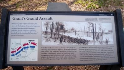
Grant's Grand Assault
Oscar Waite, 10th Vermont Infantry
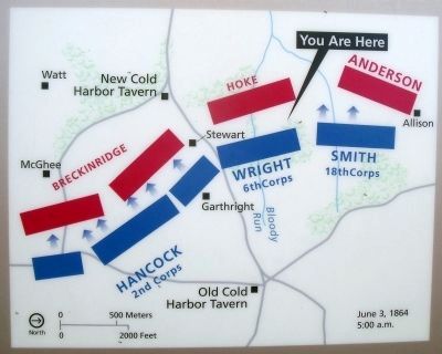
Cold Harbor is best known today for high losses among the attacking Union formations on June 3. The Sixth Corps made a small advance here, but most of the famous carnage occurred elsewhere. A few hundred yards to the north (your right), strongly entrenched Confederates easily smashed an isolated attack by the Eighteenth Corps. A mile to the south (your left) the Second Corps had nothing to show for its heavy losses.
If Grant’s attack had proceeded exactly as planned, it would have been one of the most spectacular and complicated assaults of the war in Virginia. Instead, only three of the Union army’s five infantry corps advanced across a three-mile front. Unconnected with each other, they fought individual battles and suffered separate failures. Lack of coordination among the attackers is considered one of the primary causes of Grant’s defeat on June 3. Union soldiers occupied this line through June 12.
Erected 2010 by Richmond National Battlefield Park.
Topics. This historical marker is listed in this topic list: War, US Civil. A significant historical month for this entry is June 1940.
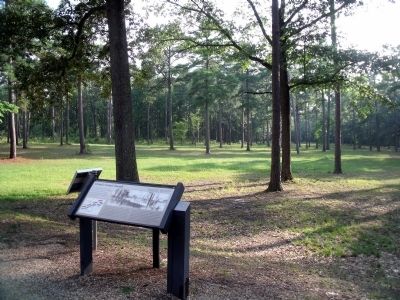
Location. 37° 35.53′ N, 77° 17.201′ W. Marker is near Mechanicsville, Virginia, in Hanover County. Marker is on Anderson-Wright Drive near Cold Harbor Road (Virginia Route 156). Touch for map. Marker is at or near this postal address: 5515 Anderson-Wright Drive, Mechanicsville VA 23111, United States of America. Touch for directions.
Other nearby markers. At least 8 other markers are within walking distance of this marker. The Cold Harbor Killing Fields (about 700 feet away, measured in a direct line); In Reserve (about 700 feet away); Between the Lines (about 700 feet away); Union Earthworks (about 800 feet away); Confederate Fortifications (about 800 feet away); Confederate Position (about 800 feet away); The Waters Ran Red (approx. ¼ mile away); A Lethal Occupation (approx. ¼ mile away). Touch for a list and map of all markers in Mechanicsville.
More about this marker. On the upper right is a sketch with the caption, "Although combat artist Alfred Waud sketched this scene elsewhere on the Cold Harbor battlefield, the landscape and situation matches the events on this ground during the Union attack on June 3."
Related marker. Click here for another marker that is related to this marker. Old Marker At This Location titled "Union Position".
Also see . . .
1. Richmond National Battlefield Park. (Submitted on August 20, 2010, by Bernard Fisher of Richmond, Virginia.)
2. Cold Harbor. CWSAC Battle Summary (Submitted on August 20, 2010.)
3. Cold Harbor. Civil War Preservation Trust (Submitted on August 20, 2010, by Bernard Fisher of Richmond, Virginia.)
Credits. This page was last revised on November 5, 2021. It was originally submitted on August 20, 2010, by Bernard Fisher of Richmond, Virginia. This page has been viewed 926 times since then and 20 times this year. Photos: 1, 2, 3, 4. submitted on August 20, 2010, by Bernard Fisher of Richmond, Virginia.


