3 entries match your criteria.
Related Historical Markers
By Cosmos Mariner, May 14, 2016
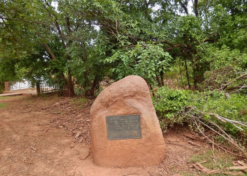
Texan Santa Fe Expedition Marker (wide view; Wichita River overlook in background on left)
SHOWN IN SOURCE-SPECIFIED ORDER
| Near Sunset Drive, 0.1 miles north of 3rd Street, on the right when traveling north. |
| | The Texan Santa Fe Expedition crossed the Wichita River near this spot August 4, 1841 Wichita Falls Junior Historians sponsored this marker on the Expedition’s 100th anniversary. — — Map (db m128805) HM |
| On SH-29, on the right when traveling west. |
| | A dramatic chapter in administration (1838-1841) of Republic of Texas President Mirabeau B. Lamar. Aware of United States – Mexico commerce crossing Texas by the Santa Fe Trail near the Canadian River, President Lamar sought similar trade . . . — — Map (db m25210) HM |
| On Ranch to Market Road 1065, 0.4 miles south of Farm to Market Road 689, on the left when traveling south. |
| | In an effort to establish a western trade route and expand Texas jurisdiction, Republic of Texas President Mirabeau B. Lamar sent an expedition of merchants, along with a military escort, to Santa Fe in 1841. The group left Brushy Creek north of . . . — — Map (db m155171) HM |
May. 4, 2024