Near Georgetown in Williamson County, Texas — The American South (West South Central)
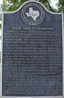
Texan Santa Fe Expedition
He initiated the Texan Santa Fe Expedition early in 1841, with Dr. Richard F. Brenham, Col. Wm. G. Cooke and Jose Antonio Navarro as commissioners. Cooke began recruiting in April, forming an artillery and five infantry companies. Remainder of 321 members included merchants (with $200,000 worth of goods), teamsters, guides and others. George W. Kendall, of the New Orleans “Picayune”, joined to write classic book on the venture. Travel was by 21 slow ox-wagons.
First day’s march, June 19, 1841, ended on the San Gabriel, and expedition’s campsite is near here.
Before reaching the Santa Fe Trail some 600 miles north, the men were to have torturing experiences with drought and unknown terrain. Ill from hardships, the group was betrayed into the hands of Mexican authorities and sent as prisoners to Mexico City. However, this penetration of upper Texas gave the republic stronger claims to her northern lands.
Erected 1970 by the State Historical Survey Committee. (Marker Number 9362.)
Topics. This historical marker is listed in these topic lists: Notable Places • Roads & Vehicles. A significant historical date for this entry is June 19, 1864.
Location. 30° 38.699′ N, 97° 35.55′ W. Marker is near Georgetown, Texas, in Williamson County. Marker is on SH-29, on the right when traveling west. 2.3 miles east of TX-130. Touch for map. Marker is in this post office area: Georgetown TX 78626, United States of America. Touch for directions.
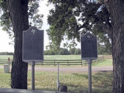
Other nearby markers. At least 8 other markers are within 4 miles of this marker, measured as the crow flies. The Double File Trail (Georgetown) (here, next to this marker); Mankins Crossing (approx. 0.6 miles away); Weir Community Cemetery (approx. 1.4 miles away); City of Weir (approx. 2.1 miles away); Pennington Family Cemetery (approx. 2.9 miles away); Community of Jonah (approx. 3.1 miles away); Jesse Cooper House (approx. 3.2 miles away); John Berry, Frontiersman (approx. 3.8 miles away). Touch for a list and map of all markers in Georgetown.
Also see . . .
1. Mirabeau B. Lamar from Texas State Library. (Submitted on December 11, 2009, by Bill Pfingsten of Bel Air, Maryland.)
2. A portion of Kendall's account of the Texan Santa Fe Expedition. (Submitted on October 26, 2016, by J. Makali Bruton of Accra, Ghana.)
Credits. This page was last revised on October 26, 2016. It was originally submitted on December 6, 2009, by Keith Peterson of Cedar Park, Texas. This page has been viewed 1,139 times since then and 42 times this year. Photos: 1. submitted on December 6, 2009, by Keith Peterson of Cedar Park, Texas. 2. submitted on August 22, 2015, by QuesterMark of Fort Worth, Texas. • Bill Pfingsten was the editor who published this page.

