Fort Monroe in Hampton, Virginia — The American South (Mid-Atlantic)
Fort Monroe
Freedom’s Fortress
— 1862 Peninsula Campaign —
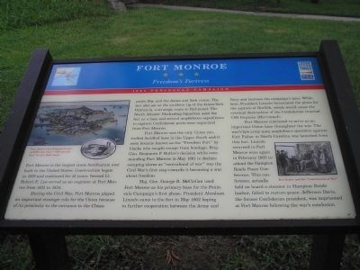
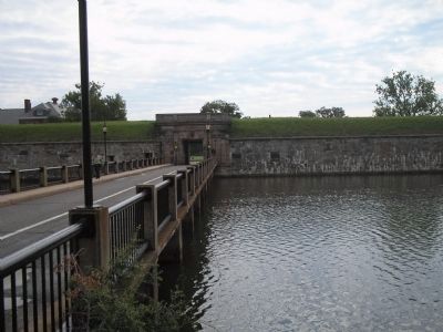
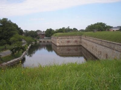
Fort Monroe is the largest stone fortification ever built in the United States. Construction began in 1819 and continued for 15 years. Second Lt. Robert E. Lee served as an engineer at Fort Monroe from 1831 to 1834.
During the Civil War, Fort Monroe played an important strategic role for the Union because of its proximity to the entrance to the Chesapeake Bay, and the James and York rivers. The fort also sat on the southern tip of the James/York Peninsula, a strategic route to Richmond. The North Atlantic Blockading Squadron used the fort as a base and several amphibious expeditions to capture Confederate ports were organized from Fort Monroe.
Fort Monroe was the only Union controlled fortified base in the Upper South and it soon became known as the “Freedom Fort” by blacks who sought escape from bondage. Brig. Gen. Benjamin F. Butler’s decision while commanding Fort Monroe in May 1861 to declare escaping slaves as “contraband of war” was the Civil War’s first step towards it becoming a war about freedom.
Maj. Gen. George B. McClellan used Fort Monroe as his primary base for the Peninsula Campaign’s first phase. President Abraham Lincoln came to the fort in May 1862 hoping to further cooperation between the Army and Navy and increase the campaign’s pace. While here, President Lincoln formulated the plans for the capture of Norfolk, which would cause the eventual destruction of the Confederate ironclad CSS Virginia (Merrimack).
Fort Monroe continued to serve as an important Union base throughout the war. The war’s last army-navy amphibious operation against Fort Fisher in North Carolina was launched from this fort. Lincoln returned to Fort Monroe once again in February 1865 to attend the Hampton Roads Peace Conference. This conference, actually held on board a steamer in Hampton Roads harbor, failed to restore peace. Jefferson Davis, the former Confederate president, was imprisoned at Fort Monroe following the war’s conclusion.
Erected by Virginia Civil War Trails.
Topics and series. This historical marker is listed in these topic lists: Forts and Castles • Military • Notable Buildings • Notable Places • War, US Civil. In addition, it is included in the Former U.S. Presidents: #16 Abraham Lincoln, and the Virginia Civil War Trails series lists. A significant historical month for this entry is February 1865.
Location. This marker has been replaced by another marker nearby. 37° 0.151′ N, 76° 18.6′ W. Marker has been damaged. Marker is in Hampton, Virginia. It is in Fort Monroe. Marker is on Bernard Road, on the right when traveling south. Touch for map. Marker is in this post office area: Fort Monroe VA 23651, United States of America. Touch for directions.
Other nearby markers. At least 8 other markers are within walking distance of this location. Eprouvette Mortar (here, next to this marker); 12-Pounder Howitzer (here, next to this marker); a different marker also named Fort Monroe (a few steps from this marker); The Old Cistern (a few steps from this marker); Lantaka (a few steps from this marker); Austrian 6-Pounder Gun (within shouting distance of this marker); a different marker also named Austrian 6-Pounder Gun (within shouting distance of this marker); John Mitchel (within shouting distance of this marker). Touch for a list and map of all markers in Hampton.
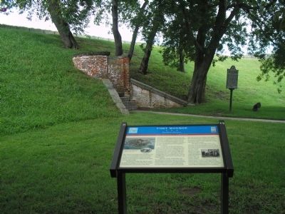
More about this marker. The upper left of the marker contains pictures of “Fort Monroe and Hampton Roads – A Bird’s Eye View” and “The Lincoln Gun” by E.S. Hall. The right of the marker features a picture of “Ben Butler and the ‘Contrabands of War’.”
Related marker. Click here for another marker that is related to this marker. This marker has been replaced with the linked marker which slightly different formatting and text.
Also see . . .
1. Unofficial Fort Monroe website. (Submitted on August 17, 2008, by Bill Coughlin of Woodland Park, New Jersey.)
2. Tidewater Virginia, The 1862 Peninsula Campaign. Civil War Traveler. (Submitted on August 17, 2008, by Bill Coughlin of Woodland Park, New Jersey.)
3. Fort Monroe. (PDF) National Register documentation for Fort Monroe. (Submitted on August 17, 2008, by Craig Swain of Leesburg, Virginia.)
4. Fort Monroe National Monument, National Park Service. (Submitted on August 19, 2019.)
Credits. This page was last revised on February 1, 2023. It was originally submitted on August 17, 2008, by Bill Coughlin of Woodland Park, New Jersey. This page has been viewed 2,192 times since then and 32 times this year. Photos: 1, 2, 3, 4, 5. submitted on August 17, 2008, by Bill Coughlin of Woodland Park, New Jersey.
