Near Scottsburg in Halifax County, Virginia — The American South (Mid-Atlantic)
Staunton River State Park
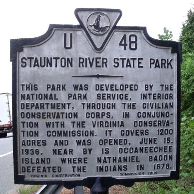
This park was developed by the National Park Service, Interior Department, through the Civilian Conservation Corps, in conjunction with the Virginia Conservation Commission. It covers 1200 acres and was opened, June 15, 1936. Near by is Occaneechee Island where Nathaniel Bacon defeated the Indians in 1676.
Erected 1939 by Virginia Conservation Commission. (Marker Number U-48.)
Topics and series. This historical marker is listed in these topic lists: Charity & Public Work • Natural Features • Natural Resources. In addition, it is included in the Civilian Conservation Corps (CCC), and the Virginia Department of Historic Resources (DHR) series lists. A significant historical date for this entry is June 15, 1887.
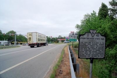
Location. This marker has been replaced by another marker nearby. It was located near 36° 46.841′ N, 78° 48.813′ W. Marker was near Scottsburg, Virginia, in Halifax County. Marker was at the intersection of James D Hagood Highway (U.S. 360) and Bethel Road (Virginia Route 360), on the right when traveling south on James D Hagood Highway. Touch for map. Marker was in this post office area: Scottsburg VA 24589, United States of America. Touch for directions.
Other nearby markers. At least 8 other markers are within 7 miles of this location, measured as the crow flies. A different marker also named Staunton River State Park (here, next to this marker); Nathaniel Terry's Grave (approx. 2.8 miles away); Henrietta Lacks (approx. 5 miles away); Mary M. Bethune High School (approx. 6.1 miles away); Halifax Court House (approx. 6.4 miles away); Halifax County War Memorial (approx. 6˝ miles away); Frank Eubank Booker, Jr. (approx. 6˝ miles away); Halifax County Confederate Monument (approx. 6˝ miles away). Touch for a list and map of all markers in Scottsburg.
Related marker. Click here for another marker that is related to this marker. New Marker At This Location also titled "Staunton River State Park".
Also see . . .
1. Staunton River State Park. Virginia Department of Conservation & Recreation (Submitted on May 21, 2010, by Bernard Fisher of Richmond, Virginia.)
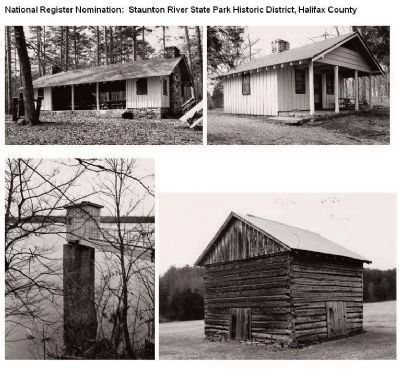
2. Staunton River State Park Historic District. Virginia Department of Historic Resources website entry (Submitted on May 21, 2010, by Bernard Fisher of Richmond, Virginia.)
Credits. This page was last revised on March 8, 2022. It was originally submitted on May 21, 2010, by Bernard Fisher of Richmond, Virginia. This page has been viewed 694 times since then and 21 times this year. Photos: 1, 2, 3. submitted on May 21, 2010, by Bernard Fisher of Richmond, Virginia.


