Rockville in Montgomery County, Maryland — The American Northeast (Mid-Atlantic)
Montgomery County Jail
Lost Rockville - 1801 to 1850
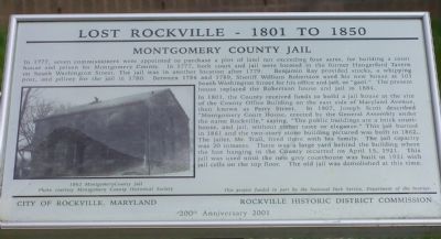
In 1777, seven commissioners were appointed to purchase a plot of land not exceeding four acres, for building a court house and prison for Montgomery County. In 1777, both court and jail were located in the former Hungerford Tavern on South Washington Street. The jail was in another location after 1779. Benjamin Ray provided stocks, a whipping post, and pillory for the jail in 1780. Between 1786 and 1789, Sheriff William Robertson used his new house at 101 South Washington Street for his office and jail, or "gaol." The present house replaced the Robertson house and jail in 1884.
In 1801, the County received funds to build a jail house at the site of the County Office Building on the east side of Maryland Avenue, then known as Perry Street. In 1807, Joseph Scott described "Montgomery Court House, erected by the General Assembly under the name Rockville," saying, "The public buildings are a brick court-house, and jail, without either taste or elegance." This jail burned in 1861 and the two-story stone building pictured was built in 1862. The jailer, Mr. Trail, lived there with his family. The jail capacity was 20 inmates. There was a large yard behind the building where the last hanging in the county occurred on April 15, 1921. This jail was used until the new grey courthouse was built in 1931 with jail cells on the top floor. The old jail was demolished at this time.
Erected 2001 by the City of Rockville Maryland and the Rockville Historic District Commission.
Topics and series. This historical marker is listed in this topic list: Notable Buildings. In addition, it is included in the Maryland, Lost Rockville – 1801 to 1850 series list. A significant historical month for this entry is April 1927.
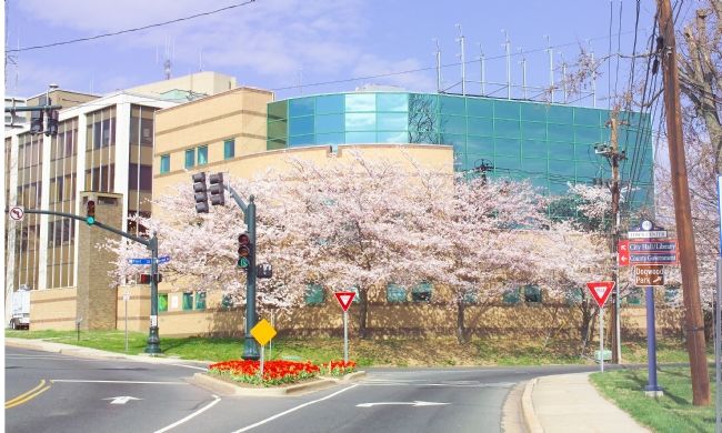
Location. This marker has been replaced by another marker nearby. It was located near 39° 4.882′ N, 77° 9.075′ W. Marker was in Rockville, Maryland, in Montgomery County. Marker was at the intersection of Maryland Avenue and Fleet Street, on the right when traveling north on Maryland Avenue. Touch for map. Marker was at or near this postal address: 120 Maryland Ave, Rockville MD 20850, United States of America. Touch for directions.
Other nearby markers. At least 5 other markers are within walking distance of this location. A different marker also named Montgomery County Jail (within shouting distance of this marker); Boundary Stone (about 300 feet away, measured in a direct line); Boundary Stone of Rockville (about 300 feet away); Christ Episcopal Church (about 600 feet away); “Out of Robb’s Window, Montgomery County Court House.” (about 600 feet away). Touch for a list and map of all markers in Rockville.
Related marker. Click here
for another marker that is related to this marker. This marker has been replaced with the linked marker.
Also see . . . Rockville History. City website entry:
Links to three walking tours (Submitted on March 28, 2022, by Larry Gertner of New York, New York.)
Credits. This page was last revised on March 28, 2022. It was originally submitted on May 2, 2006, by Tom Fuchs of Greenbelt, Maryland. This page has been viewed 4,751 times since then and 25 times this year. Photos: 1, 2. submitted on May 2, 2006, by Tom Fuchs of Greenbelt, Maryland. • J. J. Prats was the editor who published this page.

