Near Mankato in Blue Earth County, Minnesota — The American Midwest (Upper Plains)
Seppman Mill
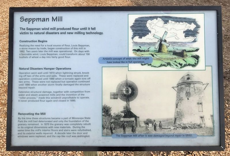
The Seppman wind mill produced flour until it fell victim to natural disasters and new milling technology.
Construction Begins
Realizing the need for a local source of flour, Louis Seppman, a stone mason by trade, began construction of this mill in 1862. Two years later the mill was operational. On days with a favorable wind, Louis Seppman, could transform about 150 bushels of wheat a day into fairly good flour.
Natural Disasters Hamper Operations
Operation went well until 1873 when lightning struck, knocking off two of the arms and sails. These were replaced and operation continued until 1880 when a tornado again tore off two arms. These were not replaced but operation continued until 1890 when another storm finally damaged the structure beyond repair.
Extensive structural damage, together with competition from water and steam powered mills and the invention of the "roller process," made this windmill unprofitable to operate. It never produced flour again and closed in 1890.
Renovating the Mill
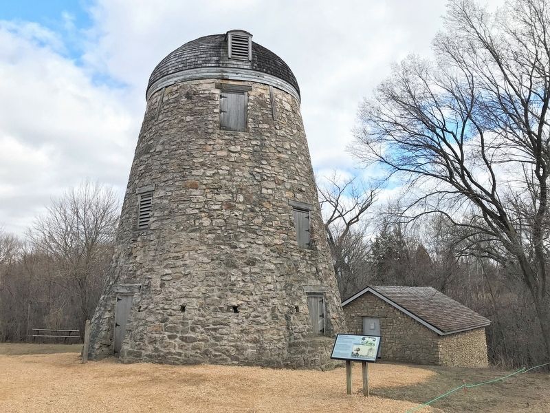
By the time these structures became a part of Minneopa State Park the mill had deteriorated and only the foundation of the granary remained. In 1970 the granary was completely rebuilt to its original dimensions with new materials. During the same time the mill's interior floors and stairs were refurbished, and its exterior walls repaired. A decade later the door and windows were replaced, and the cap-like roof was reshingled.
Captions:
Artist's concept of what the mill might have looked like in full operation.
The Seppman Mill after it was damaged beyond repair in 1890.
Topics. This historical marker is listed in this topic list: Agriculture. A significant historical year for this entry is 1862.
Location. 44° 9.845′ N, 94° 6.813′ W. Marker is near Mankato, Minnesota, in Blue Earth County. Marker can be reached from Mill Road near State Highway 68. Located at the end of the Bison Drive Road in Minneopa State Park. Touch for map. Marker is in this post office area: Mankato MN 56001, United States of America. Touch for directions.
Other nearby markers. At least 8 other markers are within 4 miles of this marker, measured as the crow flies. Granary (a few steps from this marker); The Turning Point (within shouting distance of this marker); Former Homestead of Robert & Frieda Ulmen (approx. 1.4 miles away); George M. Palmer (approx. 1˝ miles away); Minnesota State Parks (approx. 1˝ miles away); The First Mahkato Memorial Wacipi (approx. 3.6 miles away); Geology of Minnesota (approx. 3.8 miles away); Ott Cabin (approx. 3.9 miles away). Touch for a list and map of all markers in Mankato.
Related marker. Click here for another marker that is related to this marker.
Credits. This page was last revised on May 2, 2022. It was originally submitted on May 1, 2022. This page has been viewed 200 times since then and 11 times this year. Photos: 1, 2, 3. submitted on May 1, 2022.


