2 entries match your criteria.
Related Historical Markers
Old Markers At This Location: "A Thunderous Charge" was relocated after replacing and an earlier version titled "A Violent Collision of Cavalry".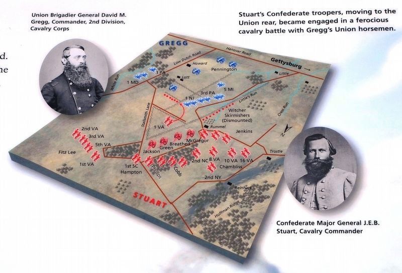
By Karl Stelly, January 25, 2021
Map of the Battle
SHOWN IN SOURCE-SPECIFIED ORDER
| 1 ► Pennsylvania, Adams County, Gettysburg, Mount Pleasant Township — A Thunderous Charge — Jul 3, 1:00-3:00 pm — Gettysburg National Military Park — |
| James Ewell Brown (J.E.B.) Stuart, Lee's cavalry commander, was the trusted eyes and ears of the Confederate Army. Absent during most of the march north, Stuart and his cavalrymen did not rejoin the Confederate Army until July 2, having left Lee . . . — — Map (db m197132) HM | |||
| 2 ► Pennsylvania, Adams County, Gettysburg, Mount Pleasant Township — A Violent Collision of Cavalry — July 3, 1863 - Third Day — Reported missing |
| "So sudden and violent was the collision that many of the horses were turned end over end, and crushed their riders beneath them." Capt. William E. Miller, U.S.A. 3rd Pennsylvania Cavalry On the afternoon of July 3, Confederate Maj. Gen. . . . — — Map (db m65716) HM | |||