3 entries match your criteria.
Related Historical Markers
By Tom Bosse, July 7, 2022
From Coal to Coke Marker
SHOWN IN SOURCE-SPECIFIED ORDER
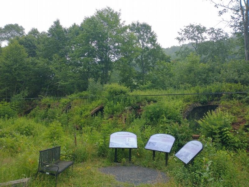
| On Rail Falls Road (Route 27/3) 0.6 miles south of Douglas Road (County Road 27), on the right when traveling south. |
| |
The soft, crumbly, low-sulfur coal extracted from this valley was ideal for processing into a charcoal-like substance called coke. Coke was and remains an essential fuel for blast furnaces in the nation's steel mills.
To turn coal into . . . — — Map (db m210124) HM |
| On Rail Falls Road (County Road 27/3) 0.6 miles south of Douglas Road (County Road 27), on the right when traveling south. |
| |
Open-shafted and surface coal mines, massive ovens, scattered coal and coking debris, smoke-belching steam engines, and construction and industrial activities all had environmental impacts. Smoke wasn’t the only consequence.
When workers . . . — — Map (db m210126) HM |
| On Rail Falls Road (County Road 27/3) 0.4 miles south of Douglas Road (County Road 27), on the right when traveling south. |
| |
The last underground coal mine closed in the early 1950s, leaving a legacy of acid mine drainage, abandoned industrial structures, coke ovens, and debris.
A major reclamation effort was conducted by the West Virginia Department of . . . — — Map (db m210127) HM |
May. 19, 2024