3 entries match your criteria.
Related Historical Markers
Markers Along the Piedmont, North Carolina Trading Path
By J. J. Prats, February 10, 2010
Trading Path Marker
SHOWN IN SOURCE-SPECIFIED ORDER
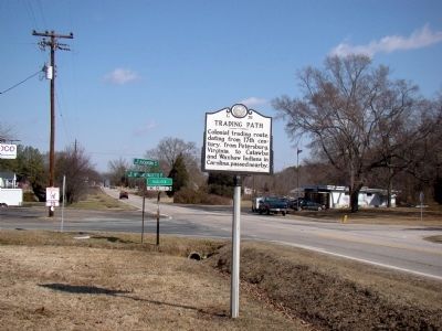
| On U.S. 15 at Buckhorn Road / Herbert Faucette Road (Local Route 1445), on the left when traveling north on U.S. 15. |
| | Colonial trading route, dating from 17th century, from Petersburg, Virginia, to Catawba and Waxhaw Indians in Carolina, passed nearby. — — Map (db m222542) HM |
| On East Center Street at N. 7th Street, on the right when traveling east on East Center Street. |
| | Colonial trading route, dating from 17th century, from Petersburg, Virginia, to the Catawba and Waxhaw Indians in Carolina, passed nearby. — — Map (db m223046) HM |
| On North Carolina 62, 0.1 miles south of Pond Road, on the right when traveling south. |
| | Colonial trading route, dating from 17th century, from Petersburg, Virginia, to Catawba and Waxhaw Indians in Carolina, passed nearby. — — Map (db m222808) HM |
May. 18, 2024