Bullock in Granville County, North Carolina — The American South (South Atlantic)
Trading Path
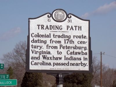
Photographed by J. J. Prats, February 10, 2010
1. Trading Path Marker
Erected 1985 by Division of Archives and History. (Marker Number G-31.)
Topics and series. This historical marker is listed in these topic lists: Colonial Era • Indigenous Peoples and Communities • Roads & Vehicles. In addition, it is included in the North Carolina Division of Archives and History series list.
Location. 36° 29.463′ N, 78° 32.7′ W. Marker is in Bullock, North Carolina, in Granville County. It is at the intersection of U.S. 15 and Buckhorn Road / Herbert Faucette Road (Local Route 1445), on the left when traveling north on U.S. 15. Touch for map. Marker is at or near this postal address: 8676 US-15, Bullock NC 27507, United States of America. Touch for directions.

Regionally, this marker is in North Carolina’s Piedmont. It is also in the American South and specifically in the Upper South. Globally, it is in North America, the Western Hemisphere, the Western World, and the Anglosphere. Historically,
this page online
Other nearby markers. At least 8 other markers are within 8 miles of this marker, measured as the crow flies: Tungsten Queen (a few steps from this marker); Henry Pattillo (approx. 1.8 miles away); John Penn (approx. 3.4 miles away); Occaneechi Indians (approx. 3.7 miles away in Virginia); Nutbush Address (approx. 6.7 miles away); John Lederer (approx. 7.2 miles away); Williamsborough (approx. 7½ miles away); Bingham School (approx. 7.6 miles away). Touch for a list and map of all markers in Bullock.
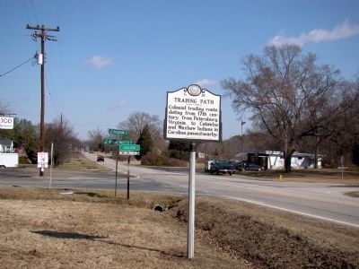
Photographed by J. J. Prats, February 10, 2010
2. Trading Path Marker
Credits. This page was last revised on May 8, 2023. It was originally submitted on February 12, 2010, by J. J. Prats of Powell, Ohio. This page has been viewed 1,533 times since then and 42 times this year. Last updated on May 8, 2023, by Michael Buckner of Durham, North Carolina. Photos: 1, 2. submitted on February 12, 2010, by J. J. Prats of Powell, Ohio.
